Trail Walking Quaix-en-Chartreuse - L'Aiguille de Quaix - Quaix-en-Chartreuse - Photo

L'Aiguille de Quaix - Quaix-en-Chartreuse

 tracegps
tracegps

User

© OpenStreetMap contributors
Length
Length
8.5 km
Max alt
Max alt
1104 m
Uphill gradient
Uphill gradient
694 m
Km-Effort
Km-Effort  
17.7 km
Min alt
Min alt
529 m
Downhill gradient
Downhill gradient
694 m
Boucle
Boucle
Yes
Creation date :
2014-12-10 00:00:00.0
Updated on :
2014-12-10 00:00:00.0

(0 Reviews)

Walking
Walking
2h30
Difficulty : Difficult

Scan this QR Code to open this trail in the SityTrail application

FREE GPS app for hiking

Logo SityTrail SityTrail

IGN / Geographical institutes

Download SityTrail from the App Store Download SityTrail from Google Play

Logo SityTrail SityTrail World

The world is yours!

Download SityTrail from the App Store Download SityTrail from Google Play Download SityTrail on Huawei AppGallery

About

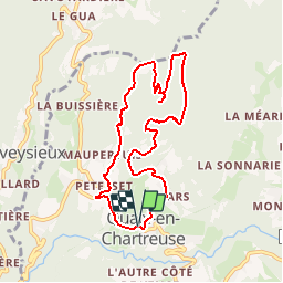
Trail Walking of 8.5 km to be discovered at Auvergne-Rhône-Alpes, Isère, Quaix-en-Chartreuse. This trail is proposed by tracegps.

Description

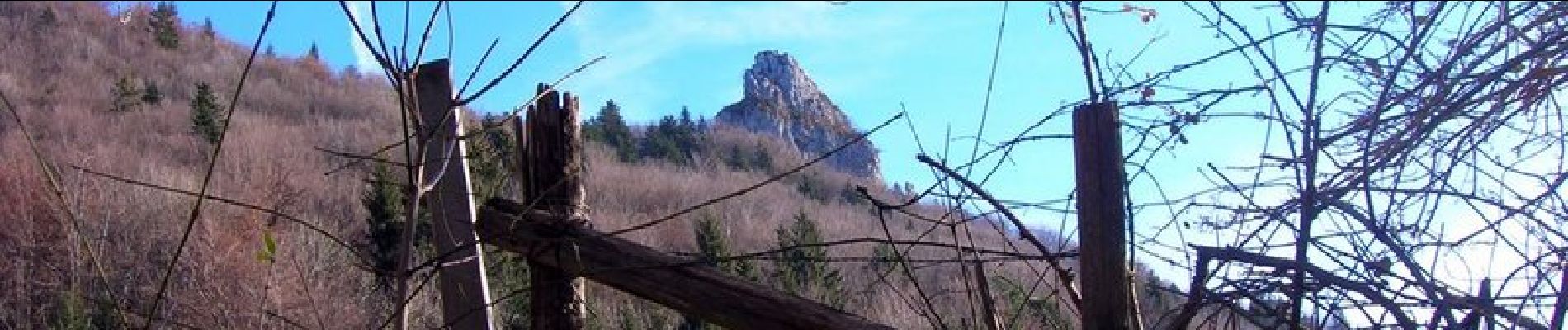
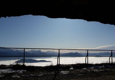
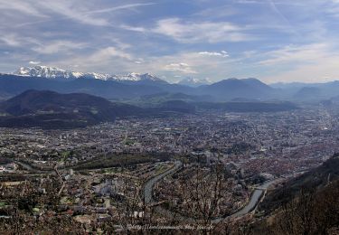
L'Aiguille de Quaix, qui surplombe le village, offre un panorama magnifique sur les 2 vallées qui l'entourent. Le terrain devient difficilement praticable après de fortes précipitations, et la boucle présente un dénivelé assez important pour atteindre l'aiguille. Bref, une rando courte et à la fois physique.

Elevation profile

Photos

Positioning

Country:
France
Region :
Auvergne-Rhône-Alpes
Department/Province :
Isère
Municipality :
Quaix-en-Chartreuse
Location:
Unknown
Start:(UTM)
713200 ; 5014677 (31T) N.

Trails nearby

Trail Nordic walking Sassenage - Parc de l'Ovalie - Noyarey - Photo
Nordic walking
patjobou

Nordic walking

Easy
(1)
Sassenage, Auvergne-Rhône-Alpes, Isère, France
11.8 km | 13 km-effort
2h 20min
No
Trail Walking Corenc - Mont Saint-Eynard par le Pas Guiguet  - Photo
Walking
cmarit

Walking

Difficult
(2)
Corenc, Auvergne-Rhône-Alpes, Isère, France
10.9 km | 26 km-effort
6h 5min
Yes
Trail Walking Voreppe - Le Rocher de Lorzier, 1838m - Photo
Walking
tracegps

Walking

Medium
(2)
Voreppe, Auvergne-Rhône-Alpes, Isère, France
12.3 km | 25 km-effort
4h 45min
Yes
Trail Walking Sarcenas - Chamechaude par le Jardin, depuis le Col de Porte - Photo
Walking
tracegps

Walking

Difficult
(2)
Sarcenas, Auvergne-Rhône-Alpes, Isère, France
10 km | 23 km-effort
6h 19min
Yes
Trail Walking Proveysieux - le rocher de l'Eglise en traversee - Photo
Walking
cmarit

Walking

Difficult
(1)
Proveysieux, Auvergne-Rhône-Alpes, Isère, France
10.5 km | 22 km-effort
8h 16min
Yes
Trail Walking Corenc - Mont Rachais par Corenc - Photo
Walking
flip38

Walking

Medium
Corenc, Auvergne-Rhône-Alpes, Isère, France
13.8 km | 25 km-effort
4h 26min
Yes
Trail Walking Mont-Saint-Martin - la Meulière des Dauphins par Mont St Martin - Photo
Walking
Ak38

Walking

Medium
Mont-Saint-Martin, Auvergne-Rhône-Alpes, Isère, France
6.3 km | 11.1 km-effort
1h 52min
Yes
Trail Touring skiing Proveysieux - 140124 Mont Fromage - Photo
Touring skiing
mzonzon05

Touring skiing

Easy
Proveysieux, Auvergne-Rhône-Alpes, Isère, France
8.5 km | 18 km-effort
3h 21min
Yes
Trail Walking Mont-Saint-Martin - 111123 - Photo
Walking
mzonzon05

Walking

Medium
Mont-Saint-Martin, Auvergne-Rhône-Alpes, Isère, France
4.2 km | 9.3 km-effort
1h 54min
Yes


Close
My subscriptions