![](/images/other/stat-length.png)
![Trail Mountain bike Saint-André-de-Cubzac - La Cubzaguaise 2013 - Photo](https://media.geolcdn.com/t/1900/400/ext.pjpeg?maxdim=2&url=https%3A%2F%2Fstatic1.geolcdn.com%2Fsiteimages%2Fupload%2Ffiles%2F1524743154velo.jpg)
La Cubzaguaise 2013
FranckBag
User
![Length](/images/other/stat-length.png)
Length
32 km
![Max alt](https://static1.geolcdn.com/siteimages/upload/files/1508320355ic_sort_altitude_max_24dp.png)
Max alt
67 m
![Uphill gradient](https://static1.geolcdn.com/siteimages/upload/files/1508320355ic_sort_den_pos_24dp.png)
Uphill gradient
316 m
![Km-Effort](/images/other/stat-length.png)
Km-Effort
36 km
![Min alt](https://static1.geolcdn.com/siteimages/upload/files/1508320355ic_sort_altitude_min_24dp.png)
Min alt
0 m
![Downhill gradient](https://static1.geolcdn.com/siteimages/upload/files/1508320355ic_sort_den_neg_24dp.png)
Downhill gradient
317 m
![Boucle](https://static1.geolcdn.com/siteimages/upload/files/16400158638029165_repeat_loop_refresh_sync_direction_icon.png)
Boucle
Yes
Creation date :
2014-12-10 00:00:00.0
Updated on :
2014-12-10 00:00:00.0
![Mountain bike](https://static1.geolcdn.com/sitytour/trail-icons/202.png)
2h23
Difficulty : Medium
![Scan this QR Code to open this trail in the SityTrail application](https://capi.geolives.com/qq0zvz2zws4bq2lad0pu/sitytour/trails/198540/qr.png?size=200)
FREE GPS app for hiking
About
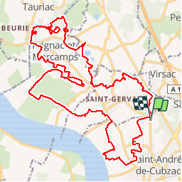
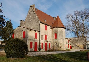
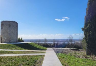
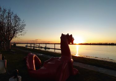
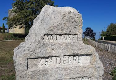
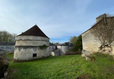
Trail Mountain bike of 32 km to be discovered at New Aquitaine, Gironde, Saint-André-de-Cubzac. This trail is proposed by FranckBag.
Description
Parcours 32 km sans le petit single de fin (problème de balisage). Circuit roulant, peu technique, passages très boueux par temps de pluie.
Positioning
Country:
France
Region :
New Aquitaine
Department/Province :
Gironde
Municipality :
Saint-André-de-Cubzac
Location:
Unknown
Start:(Dec)
Start:(UTM)
701122 ; 4987311 (30T) N.
Comments
Trails nearby
![Trail Walking Saint-André-de-Cubzac - Boucle St André - Photo](https://media.geolcdn.com/t/375/260/ext.jpg?maxdim=2&url=https%3A%2F%2Fmedia.geolcdn.com%2Ff%2F3b2cb73f-e91d-4da2-8005-6a734b71af46.jpg)
![Walking Walking](https://static1.geolcdn.com/sitytour/trail-icons/101.png)
Boucle St André
Walking
Easy
Saint-André-de-Cubzac,
New Aquitaine,
Gironde,
France
![](/images/other/stat-length.png)
5.2 km | 5.9 km-effort
1h 17min
![](https://static1.geolcdn.com/siteimages/upload/files/16400158638029165_repeat_loop_refresh_sync_direction_icon.png)
Yes
![Trail Walking Saint-André-de-Cubzac - SAINT ANDRE campagne 8.2 km - Photo](https://media.geolcdn.com/t/375/260/ext.jpg?maxdim=2&url=https%3A%2F%2Fmedia.geolcdn.com%2Ff%2F5a3a7ec0-cadd-4e90-9e7e-9c8d0d2d650d.jpg)
![Walking Walking](https://static1.geolcdn.com/sitytour/trail-icons/101.png)
SAINT ANDRE campagne 8.2 km
Walking
Medium
Saint-André-de-Cubzac,
New Aquitaine,
Gironde,
France
![](/images/other/stat-length.png)
8.2 km | 9.5 km-effort
2h 10min
![](https://static1.geolcdn.com/siteimages/upload/files/16400158638029165_repeat_loop_refresh_sync_direction_icon.png)
Yes
![Trail Walking Prignac-et-Marcamps - Prignac et mrc - Photo](https://media.geolcdn.com/t/375/260/ext.jpg?maxdim=2&url=https%3A%2F%2Fmedia.geolcdn.com%2Ff%2Fa2f85a4b-fec6-49e1-8ec2-5e4e8a719a51.jpg)
![Walking Walking](https://static1.geolcdn.com/sitytour/trail-icons/101.png)
Prignac et mrc
Walking
Very easy
Prignac-et-Marcamps,
New Aquitaine,
Gironde,
France
![](/images/other/stat-length.png)
12.1 km | 13.8 km-effort
3h 17min
![](https://static1.geolcdn.com/siteimages/upload/files/16400158638029165_repeat_loop_refresh_sync_direction_icon.png)
Yes
![Trail Walking Saint-André-de-Cubzac - BALADE COTEAU DE MONTALON - Photo](https://media.geolcdn.com/t/375/260/ext.jpg?maxdim=2&url=https%3A%2F%2Fmedia.geolcdn.com%2Ff%2F6707bce7-330c-4003-84a4-f597d0484788.jpg)
![Walking Walking](https://static1.geolcdn.com/sitytour/trail-icons/101.png)
BALADE COTEAU DE MONTALON
Walking
Easy
Saint-André-de-Cubzac,
New Aquitaine,
Gironde,
France
![](/images/other/stat-length.png)
3.8 km | 4.7 km-effort
1h 4min
![](https://static1.geolcdn.com/siteimages/upload/files/16400158638029165_repeat_loop_refresh_sync_direction_icon.png)
Yes
![Trail Walking Saint-André-de-Cubzac - Parc Robillard • Moulin de Montalon - Photo](https://media.geolcdn.com/t/375/260/ext.jpg?maxdim=2&url=https%3A%2F%2Fmedia.geolcdn.com%2Ff%2F0f602389-b720-4696-9a01-c175f2bc0445.JPG)
![Walking Walking](https://static1.geolcdn.com/sitytour/trail-icons/101.png)
Parc Robillard • Moulin de Montalon
Walking
Easy
Saint-André-de-Cubzac,
New Aquitaine,
Gironde,
France
![](/images/other/stat-length.png)
2.8 km | 3.5 km-effort
48min
![](https://static1.geolcdn.com/siteimages/upload/files/16400158638029165_repeat_loop_refresh_sync_direction_icon.png)
Yes
![Trail Walking Saint-André-de-Cubzac - Port de Plagne - Photo](https://media.geolcdn.com/t/375/260/ext.jpg?maxdim=2&url=https%3A%2F%2Fmedia.geolcdn.com%2Ff%2Fcab73ebe-96f0-4591-a7ff-749602b5d27a.JPG)
![Walking Walking](https://static1.geolcdn.com/sitytour/trail-icons/101.png)
Port de Plagne
Walking
Easy
Saint-André-de-Cubzac,
New Aquitaine,
Gironde,
France
![](/images/other/stat-length.png)
2.7 km | 2.9 km-effort
39min
![](https://static1.geolcdn.com/siteimages/upload/files/16400158638029165_repeat_loop_refresh_sync_direction_icon.png)
Yes
![Trail Walking Saint-André-de-Cubzac - Campagne St André - Plagne / Chateau du Bouilh - Photo](https://media.geolcdn.com/t/375/260/ext.jpg?maxdim=2&url=https%3A%2F%2Fmedia.geolcdn.com%2Ff%2F8dbfe052-e63d-4ab9-b154-f2c11a963f59.JPG)
![Walking Walking](https://static1.geolcdn.com/sitytour/trail-icons/101.png)
Campagne St André - Plagne / Chateau du Bouilh
Walking
Medium
Saint-André-de-Cubzac,
New Aquitaine,
Gironde,
France
![](/images/other/stat-length.png)
9.2 km | 10.7 km-effort
2h 17min
![](https://static1.geolcdn.com/siteimages/upload/files/16400158638029165_repeat_loop_refresh_sync_direction_icon.png)
Yes
![Trail Walking Prignac-et-Marcamps - mugron a partir de saint michel - Photo](https://media.geolcdn.com/t/375/260/ext.jpg?maxdim=2&url=https%3A%2F%2Fstatic1.geolcdn.com%2Fsiteimages%2Fupload%2Ffiles%2F1553511878bg_sport_marche.png)
![Walking Walking](https://static1.geolcdn.com/sitytour/trail-icons/101.png)
mugron a partir de saint michel
Walking
Easy
Prignac-et-Marcamps,
New Aquitaine,
Gironde,
France
![](/images/other/stat-length.png)
3.6 km | 4 km-effort
1h 4min
![](https://static1.geolcdn.com/siteimages/upload/files/16400158638029165_repeat_loop_refresh_sync_direction_icon.png)
Yes
![Trail Walking Saint-Gervais - St gervais - Photo](https://media.geolcdn.com/t/375/260/ext.jpg?maxdim=2&url=https%3A%2F%2Fmedia.geolcdn.com%2Ff%2F08ef7adc-ac01-45f6-9242-eb24438739ce.jpg)
![Walking Walking](https://static1.geolcdn.com/sitytour/trail-icons/101.png)
St gervais
Walking
Easy
Saint-Gervais,
New Aquitaine,
Gironde,
France
![](/images/other/stat-length.png)
12 km | 13.2 km-effort
2h 39min
![](https://static1.geolcdn.com/siteimages/upload/files/16400158638029165_repeat_loop_refresh_sync_direction_icon.png)
Yes