Trail Mountain bike Choisy-le-Roi - lac de choisy - Photo
© OpenStreetMap contributors
Length
Length
9.3 km
Max alt
Max alt
38 m
Uphill gradient
Uphill gradient
64 m
Km-Effort
Km-Effort  
10.2 km
Min alt
Min alt
24 m
Downhill gradient
Downhill gradient
65 m
Boucle
Boucle
Yes
Creation date :
2014-12-10 00:00:00.0
Updated on :
2014-12-10 00:00:00.0

(0 Reviews)

Mountain bike
Mountain bike
40m
Difficulty : Easy

Scan this QR Code to open this trail in the SityTrail application

FREE GPS app for hiking

Logo SityTrail SityTrail

IGN / Geographical institutes

Download SityTrail from the App Store Download SityTrail from Google Play

Logo SityTrail SityTrail World

The world is yours!

Download SityTrail from the App Store Download SityTrail from Google Play Download SityTrail on Huawei AppGallery

About

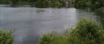
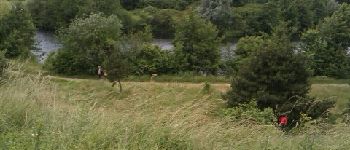
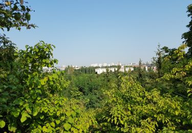
Trail Mountain bike of 9.3 km to be discovered at Ile-de-France, Val-de-Marne, Choisy-le-Roi. This trail is proposed by fishmamsk8.

Description

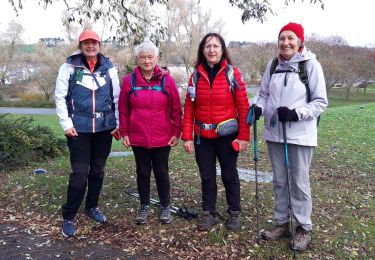
Promenade dans le parc départemental des sports

Elevation profile

Photos

Points of interest

Point of interest Choisy-le-Roi - Lac  de Choisy le Roi - Photo
fishmamsk8
CHOISY-LE-ROI 
Point of interest Villeneuve-Saint-Georges - Point 6 - Photo
fishmamsk8
VILLENEUVE-SAINT-GEORGES 
Point of interest Villeneuve-Saint-Georges - Point 7 - Photo
fishmamsk8
VILLENEUVE-SAINT-GEORGES 
Point of interest Choisy-le-Roi - Point 8 - Photo
fishmamsk8
CHOISY-LE-ROI 

Positioning

Country:
France
Region :
Ile-de-France
Department/Province :
Val-de-Marne
Municipality :
Choisy-le-Roi
Location:
Unknown
Start:(UTM)
457717 ; 5401179 (31U) N.

Trails nearby

Trail On foot Créteil - JC 84 - La Végétale - 18,2 km - Photo
On foot

On foot

Difficult
(1)
Créteil, Ile-de-France, Val-de-Marne, France
18.3 km | 21 km-effort
4h 40min
No
Trail Walking Créteil - Parc départemental et tour lac Créteil 15 km - Photo
Walking
GUIDE
jeanmarcMasson

Walking

Difficult
(1)
Créteil, Ile-de-France, Val-de-Marne, France
14.4 km | 16.2 km-effort
3h 41min
Yes
Trail Walking Saint-Maur-des-Fossés - Boucle de la Marne Saint MAUR des Fosses - Photo
Walking
Prala

Walking

Easy
(2)
Saint-Maur-des-Fossés, Ile-de-France, Val-de-Marne, France
13 km | 14.1 km-effort
2h 12min
Yes
Trail Walking Thiais - 5km - Photo
Walking
ged94

Walking

Very easy
Thiais, Ile-de-France, Val-de-Marne, France
4.9 km | 5.3 km-effort
1h 1min
Yes
Trail Running Saint-Maur-des-Fossés - Rando 24 km de Saint Maur à Boissy Saint Léger - Photo
Running
benoit92320

Running

Very easy
(1)
Saint-Maur-des-Fossés, Ile-de-France, Val-de-Marne, France
24 km | 27 km-effort
6h 0min
No
Trail Walking Ablon-sur-Seine - Ablon /Choisy-le-roi - Photo
Walking
gdela

Walking

Easy
Ablon-sur-Seine, Ile-de-France, Val-de-Marne, France
19.9 km | 21 km-effort
4h 14min
Yes
Trail Walking Villeneuve-Saint-Georges - Plage bleu Valenton - Photo
Walking
GUIDE
jeanmarcMasson

Walking

Medium
Villeneuve-Saint-Georges, Ile-de-France, Val-de-Marne, France
6 km | 6.6 km-effort
1h 53min
Yes
Trail Walking Saint-Maur-des-Fossés - Boucle de la Marne de Saint-Maur à Joinville - Photo
Walking

Walking

Medium
Saint-Maur-des-Fossés, Ile-de-France, Val-de-Marne, France
13.1 km | 14.2 km-effort
3h 20min
Yes
Trail Other activity Paray-Vieille-Poste - Toulouse - Photo
Other activity
Aragier

Other activity

Very easy
Paray-Vieille-Poste, Ile-de-France, Essonne, France
609 km | 779 km-effort
1h 6min
No


Close
My subscriptions