


3.7 km | 4 km-effort
![Trail Walking Lyon - [TEST] Fête des lumières à Lyon - Photo](https://media.geolcdn.com/t/1900/400/ext.pjpeg?maxdim=2&url=https%3A%2F%2Fmedia.geolcdn.com%2Ff%2F560949a4-103c-40f8-8858-2d7089db2b2d.jpg)

User


FREE GPS app for hiking
 SityTrail
IGN / Geographical institutes
SityTrail World
The world is yours!
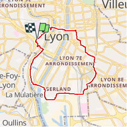
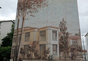
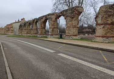
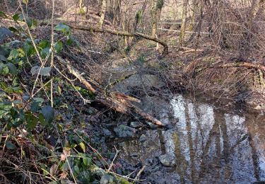
Trail Walking of 14.2 km to be discovered at Auvergne-Rhône-Alpes, Métropole de Lyon, Lyon. This trail is proposed by Benoît BS .
La Fête des Lumières, s'appuie sur la fête religieuse dite fête du 8 décembre, fête de l'immaculée conception, Illuminations ou encore fête de la Vierge Marie. C'est devenu une manifestation populaire, initiée par la ville de Lyon en 1989, qui se tient chaque année pendant quatre jours autour du 8 décembre, date traditionnelle de l'événement, à Lyon (France).
![Trail Walking Lyon - [TEST] Fête des lumières à Lyon - Photo 1](https://media.geolcdn.com/t/2048/auto/560949a4-103c-40f8-8858-2d7089db2b2d.jpg&format=jpg&maxdim=0 "Trail Walking Lyon - [TEST] Fête des lumières à Lyon - Photo 1")
![Trail Walking Lyon - [TEST] Fête des lumières à Lyon - Photo 2](https://media.geolcdn.com/t/2048/auto/2b5be074-c18b-4282-857e-8cf0632a69d0.jpg&format=jpg&maxdim=0 "Trail Walking Lyon - [TEST] Fête des lumières à Lyon - Photo 2")
![Trail Walking Lyon - [TEST] Fête des lumières à Lyon - Photo 3](https://media.geolcdn.com/t/2048/auto/720fa645-6b66-4f9f-bb68-2785bc32ee93.jpg&format=jpg&maxdim=0 "Trail Walking Lyon - [TEST] Fête des lumières à Lyon - Photo 3")
![Trail Walking Lyon - [TEST] Fête des lumières à Lyon - Photo 4](https://media.geolcdn.com/t/2048/auto/28905154-f79b-433b-a18b-b20aefd9861a.jpg&format=jpg&maxdim=0 "Trail Walking Lyon - [TEST] Fête des lumières à Lyon - Photo 4")
![Trail Walking Lyon - [TEST] Fête des lumières à Lyon - Photo 5](https://media.geolcdn.com/t/2048/auto/8dc9f6dd-ba30-43c3-9958-3948b3b966d3.jpg&format=jpg&maxdim=0 "Trail Walking Lyon - [TEST] Fête des lumières à Lyon - Photo 5")
![Trail Walking Lyon - [TEST] Fête des lumières à Lyon - Photo 6](https://media.geolcdn.com/t/2048/auto/a7bf05fd-6059-4ccb-91f2-ec8990ecf65d.jpg&format=jpg&maxdim=0 "Trail Walking Lyon - [TEST] Fête des lumières à Lyon - Photo 6")
![Trail Walking Lyon - [TEST] Fête des lumières à Lyon - Photo 7](https://media.geolcdn.com/t/2048/auto/f888f305-a6b6-499b-9f42-de17b2854c19.jpg&format=jpg&maxdim=0 "Trail Walking Lyon - [TEST] Fête des lumières à Lyon - Photo 7")
![Trail Walking Lyon - [TEST] Fête des lumières à Lyon - Photo 8](https://media.geolcdn.com/t/2048/auto/40fb0f70-8019-4cbc-b39a-17786cb6bbe1.jpg&format=jpg&maxdim=0 "Trail Walking Lyon - [TEST] Fête des lumières à Lyon - Photo 8")
![Trail Walking Lyon - [TEST] Fête des lumières à Lyon - Photo 9](https://media.geolcdn.com/t/2048/auto/d651b13a-dae1-41e3-9525-a661b8395a8b.JPG&format=jpg&maxdim=0 "Trail Walking Lyon - [TEST] Fête des lumières à Lyon - Photo 9")
![Trail Walking Lyon - [TEST] Fête des lumières à Lyon - Photo 10](https://media.geolcdn.com/t/2048/auto/f819f23c-ebe7-4163-a366-35cdb6c897d6.jpg&format=jpg&maxdim=0 "Trail Walking Lyon - [TEST] Fête des lumières à Lyon - Photo 10")
![Trail Walking Lyon - [TEST] Fête des lumières à Lyon - Photo 11](https://media.geolcdn.com/t/2048/auto/0459d1a6-54a5-4f46-b7b1-642c3fe74e53.jpg&format=jpg&maxdim=0 "Trail Walking Lyon - [TEST] Fête des lumières à Lyon - Photo 11")
![Trail Walking Lyon - [TEST] Fête des lumières à Lyon - Photo 12](https://media.geolcdn.com/t/2048/auto/0d708923-9ee2-4aab-8e90-eed15b5e8a38.jpg&format=jpg&maxdim=0 "Trail Walking Lyon - [TEST] Fête des lumières à Lyon - Photo 12")
![Trail Walking Lyon - [TEST] Fête des lumières à Lyon - Photo 13](https://media.geolcdn.com/t/2048/auto/5e9914f9-895d-418e-a7d0-8a3f94780bf9.jpg&format=jpg&maxdim=0 "Trail Walking Lyon - [TEST] Fête des lumières à Lyon - Photo 13")
![Trail Walking Lyon - [TEST] Fête des lumières à Lyon - Photo 14](https://media.geolcdn.com/t/2048/auto/8a7e0518-02bb-4faf-a68d-2a28fe9bb0a8.jpg&format=jpg&maxdim=0 "Trail Walking Lyon - [TEST] Fête des lumières à Lyon - Photo 14")
![Trail Walking Lyon - [TEST] Fête des lumières à Lyon - Photo 15](https://media.geolcdn.com/t/2048/auto/bf03b1d5-ca4a-4c8b-abe5-607c3abcfa72.jpg&format=jpg&maxdim=0 "Trail Walking Lyon - [TEST] Fête des lumières à Lyon - Photo 15")
![Trail Walking Lyon - [TEST] Fête des lumières à Lyon - Photo 16](https://media.geolcdn.com/t/2048/auto/197a3778-379f-4550-ac13-3a40d4951e6b.jpg&format=jpg&maxdim=0 "Trail Walking Lyon - [TEST] Fête des lumières à Lyon - Photo 16")
Walking

Mountain bike

Walking
Walking

Mountain bike
Walking
Walking
Walking
Walking