


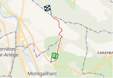
Sentier Cathares (déviation Foix/Montgailhard)

loic09
User

Length
2.8 km

Max alt
802 m

Uphill gradient
347 m
Km-Effort
6.3 km

Min alt
459 m

Downhill gradient
9 m
Boucle
No
Creation date :
2018-07-12 12:16:17.074
Updated on :
2018-07-12 12:25:33.539

FREE GPS app for hiking
 SityTrail
IGN / Geographical institutes
SityTrail Plus
The world is yours!
About
Trail of 2.8 km to be discovered at Occitania, Ariège, Montgaillard. This trail is proposed by loic09.
Description
déviation due à l'interdiction de circulation déposée par un propriétaire privé.
Positioning
Country:
France
Region :
Occitania
Department/Province :
Ariège
Municipality :
Montgaillard
Location:
Unknown
Start:(Dec)
Start:(UTM)
389074 ; 4754866 (31T) N.
Comments