Trail Mountain bike Saint-Vallier-de-Thiey - St Vallier/St Cézaire par le gazoduc AR - Photo

St Vallier/St Cézaire par le gazoduc AR

 toofastt
toofastt

User

© OpenStreetMap contributors
Length
Length
28 km
Max alt
Max alt
814 m
Uphill gradient
Uphill gradient
498 m
Km-Effort
Km-Effort  
34 km
Min alt
Min alt
483 m
Downhill gradient
Downhill gradient
503 m
Boucle
Boucle
Yes
Creation date :
2018-07-15 06:17:48.67
Updated on :
2018-07-15 10:32:58.586

(0 Reviews)

Mountain bike
Mountain bike
2h00
Difficulty : Easy

Scan this QR Code to open this trail in the SityTrail application

FREE GPS app for hiking

Logo SityTrail SityTrail

IGN / Geographical institutes

Download SityTrail from the App Store Download SityTrail from Google Play

Logo SityTrail SityTrail World

The world is yours!

Download SityTrail from the App Store Download SityTrail from Google Play Download SityTrail on Huawei AppGallery

About

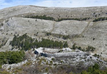
Trail Mountain bike of 28 km to be discovered at Provence-Alpes-Côte d'Azur, Maritime Alps, Saint-Vallier-de-Thiey. This trail is proposed by toofastt.

Description

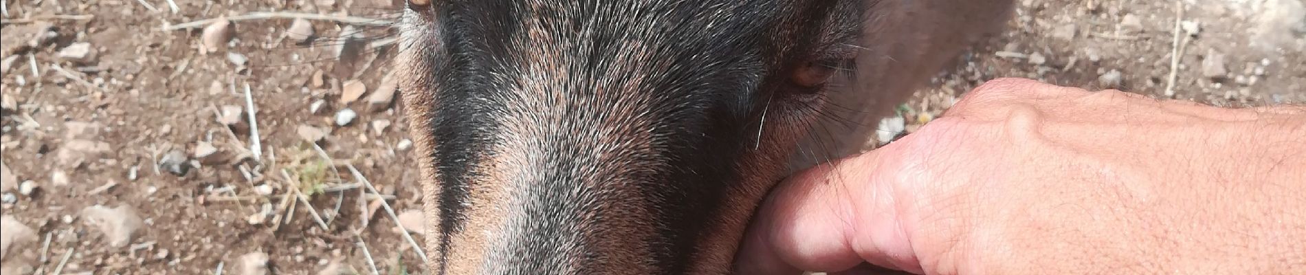
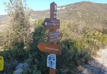
Belle rando très roulante empruntant le gazoduc et de belles pistes. Crochet par la zone incendiée à St Cézaire (travaux de débardage par l'ONF en cours sur la zone)jusqu'à la chèvrerie du bois d'Amon où j'ai été adopté par une chèvre :)
Retour par le Défends jusqu'au point de départ de la rando à l'entrée de St Vallier (parking de la station essence).

Elevation profile

Photos

Positioning

Country:
France
Region :
Provence-Alpes-Côte d'Azur
Department/Province :
Maritime Alps
Municipality :
Saint-Vallier-de-Thiey
Location:
Unknown
Start:(UTM)
327364 ; 4840068 (32T) N.

Trails nearby

Trail Walking Saint-Cézaire-sur-Siagne - Col de Cabris - Photo
Walking
jlrayon

Walking

Easy
(1)
Saint-Cézaire-sur-Siagne, Provence-Alpes-Côte d'Azur, Maritime Alps, France
7.3 km | 9.7 km-effort
3h 0min
Yes
Trail Walking Saint-Vallier-de-Thiey - St Vallier de Thiey - Col du Ferrier - Castellaras de la Malle - Col du Pilon - Pierre Druidique - Photo
Walking
LtZIP

Walking

Medium
Saint-Vallier-de-Thiey, Provence-Alpes-Côte d'Azur, Maritime Alps, France
18.9 km | 28 km-effort
6h 18min
Yes
Trail Walking Saint-Vallier-de-Thiey - Montagne de Thiey 2 - Photo
Walking
ETMU5496

Walking

Medium
Saint-Vallier-de-Thiey, Provence-Alpes-Côte d'Azur, Maritime Alps, France
19.3 km | 31 km-effort
6h 57min
Yes
Trail Walking Saint-Vallier-de-Thiey - Arche de Ponadieu Source de la Pare Baou Mourine Vieux Pont  - Photo
Walking
jouans

Walking

Very difficult
Saint-Vallier-de-Thiey, Provence-Alpes-Côte d'Azur, Maritime Alps, France
19.2 km | 32 km-effort
7h 20min
Yes
Trail Walking Saint-Vallier-de-Thiey - 2)_Baou_Mourine_par_Arche_du__Saint-Vall - Photo
Walking
ETMU5496

Walking

Difficult
Saint-Vallier-de-Thiey, Provence-Alpes-Côte d'Azur, Maritime Alps, France
19.3 km | 33 km-effort
7h 31min
Yes
Trail Walking Grasse - La croix de Cbris - Photo
Walking
56jj

Walking

Easy
Grasse, Provence-Alpes-Côte d'Azur, Maritime Alps, France
14.1 km | 19 km-effort
5h 40min
Yes
Trail Walking Saint-Vallier-de-Thiey - montagne de Thiey-forêt de Nans-19-04-23 - Photo
Walking
Christiancordin

Walking

Medium
Saint-Vallier-de-Thiey, Provence-Alpes-Côte d'Azur, Maritime Alps, France
16.1 km | 26 km-effort
4h 15min
Yes
Trail Walking Saint-Vallier-de-Thiey - Panadieu-ancienne Rte Napoléon de St Vallier à Escragnolles-18-04-23 - Photo
Walking
Christiancordin

Walking

Difficult
Saint-Vallier-de-Thiey, Provence-Alpes-Côte d'Azur, Maritime Alps, France
20 km | 32 km-effort
7h 0min
Yes
Trail Walking Saint-Vallier-de-Thiey - St Vallier de Thiey - Aqueduc de Belletrud - Arche de Ponadieu - Photo
Walking
donda

Walking

Very difficult
Saint-Vallier-de-Thiey, Provence-Alpes-Côte d'Azur, Maritime Alps, France
18.5 km | 31 km-effort
6h 56min
Yes


Close
My subscriptions