


20180702093201-nyC21

holtzv
User GUIDE
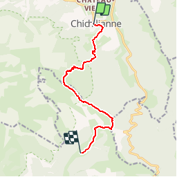

Length
9.3 km

Max alt
1682 m

Uphill gradient
793 m
Km-Effort
18.6 km

Min alt
985 m

Downhill gradient
404 m
Boucle
No
Creation date :
2018-07-16 19:51:38.828
Updated on :
2018-07-25 08:48:57.976
3h55
Difficulty : Medium

FREE GPS app for hiking
 SityTrail
IGN / Geographical institutes
SityTrail Plus
The world is yours!
About
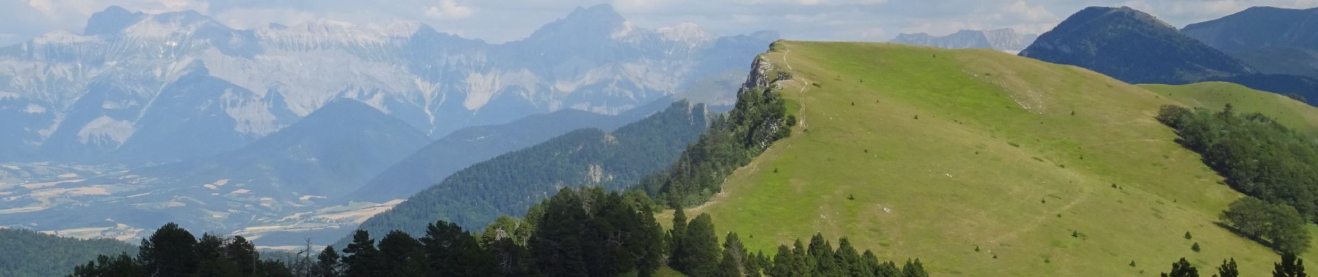
Trail Walking of 9.3 km to be discovered at Auvergne-Rhône-Alpes, Isère, Chichilianne. This trail is proposed by holtzv.
Description
De Chichiliane à Grange de Rachier_9,5km_780mPos_390mNeg
Photos

Positioning
Country:
France
Region :
Auvergne-Rhône-Alpes
Department/Province :
Isère
Municipality :
Chichilianne
Location:
Unknown
Start:(Dec)
Start:(UTM)
703429 ; 4965208 (31T) N.
Comments