Chichilianne, Isère: Best trails, routes and walks

10 comments

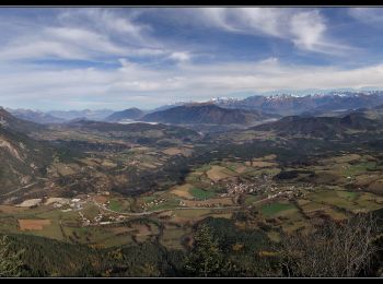
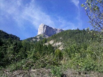
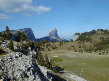
Chichilianne: Discover the best trails: 147 hiking trails, 7 bike and mountain-bike routes and 11 equestrian circuits. All these trails, routes and outdoor activities are available in our SityTrail applications for smartphones and tablets.


The best trails (180)

Trail Walking Chichilianne - Le Platary - Photo
Walking 6.577
Km

Walking

Medium
(2)
Chichilianne, Auvergne-Rhône-Alpes, Isère, France
6.6 km | 12.1 km-effort
2h 29min
417 m
419 m
Yes
patjobou

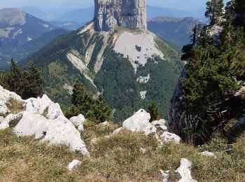
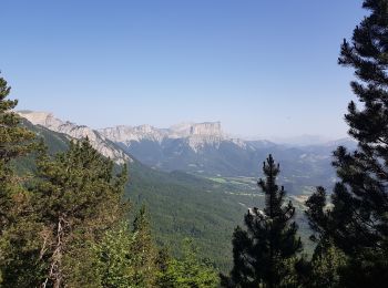
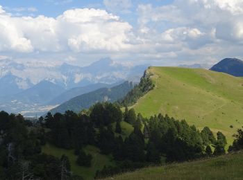
• Belle petite boucle - Très belle vue circulaire au sommet. Possible en raquettes. Si on veut continuer la crêt, il es...

Trail Walking Chichilianne - La Fontaine Pourrie - Hauts Plateaux Sud du Vercors - Photo
Walking 19.427
Km

Walking

Medium
(2)
Chichilianne, Auvergne-Rhône-Alpes, Isère, France
19.4 km | 33 km-effort
7h 45min
1002 m
1000 m
Yes
tracegps

Trail Snowshoes Chichilianne - chichilianne archiane - Photo
Snowshoes 18.897
Km

Snowshoes

Medium
(1)
Chichilianne, Auvergne-Rhône-Alpes, Isère, France
18.9 km | 32 km-effort
8h 0min
941 m
1188 m
No
jerome-dupont@laposte.net

Trail Walking Chichilianne - Esclops Trièves Tour du Mont Aiguille - Photo
Walking 16.565
Km

Walking

Difficult
Chichilianne, Auvergne-Rhône-Alpes, Isère, France
16.6 km | 32 km-effort
7h 38min
1143 m
1144 m
Yes
TOULAUDIN

Trail On foot Chichilianne - Pas de l'Aiguille - Photo
On foot 17.074
Km
PRO

On foot

Medium
Chichilianne, Auvergne-Rhône-Alpes, Isère, France
17.1 km | 29 km-effort
6h 39min
917 m
920 m
Yes
SityTrail - itinéraires balisés pédestres

Trail Walking Chichilianne - Sommets de Charbonnier & du Platary - Photo
Walking 12.051
Km

Walking

Medium
Chichilianne, Auvergne-Rhône-Alpes, Isère, France
12.1 km | 21 km-effort
5h 24min
676 m
677 m
Yes
flip38

Trail Walking Chichilianne - Autour du mont Aiguille - Photo
Walking 19.646
Km

Walking

Difficult
Chichilianne, Auvergne-Rhône-Alpes, Isère, France
19.6 km | 35 km-effort
6h 48min
1132 m
1126 m
Yes
ajd26

Trail Walking Chichilianne - La Montagnette par les pas de l'Aiguille et de l'Essaure - Photo
Walking 15.862
Km

Walking

Very difficult
Chichilianne, Auvergne-Rhône-Alpes, Isère, France
15.9 km | 29 km-effort
6h 55min
988 m
1063 m
No
GuyVachet

Trail Snowshoes Chichilianne - Pas de l'aiguille  - Photo
Snowshoes 7.94
Km

Snowshoes

Difficult
Chichilianne, Auvergne-Rhône-Alpes, Isère, France
7.9 km | 15.3 km-effort
3h 0min
552 m
555 m
Yes
meunier.ph.

Trail Walking Chichilianne - la richardiere rocher du parquet - Photo
Walking 16.713
Km

Walking

Very easy
Chichilianne, Auvergne-Rhône-Alpes, Isère, France
16.7 km | 30 km-effort
8h 19min
1010 m
1011 m
Yes
Joel26400

Trail Walking Chichilianne - Tete de Praortzel et Crête de Grande Leirie - Photo
Walking 12.351
Km

Walking

Difficult
Chichilianne, Auvergne-Rhône-Alpes, Isère, France
12.4 km | 21 km-effort
5h 39min
641 m
641 m
Yes
patjobou

Trail Walking Chichilianne - 20180607123649-yXjCl - Photo
Walking 12.473
Km
GUIDE

Walking

Very difficult
Chichilianne, Auvergne-Rhône-Alpes, Isère, France
12.5 km | 22 km-effort
4h 22min
675 m
725 m
No
holtzv

Trail Walking Chichilianne - 20180702093201-nyC21 - Photo
Walking 9.319
Km
GUIDE

Walking

Medium
Chichilianne, Auvergne-Rhône-Alpes, Isère, France
9.3 km | 18.6 km-effort
3h 55min
793 m
404 m
No
holtzv

Trail Walking Chichilianne - circuit botanique des alpages - Photo
Walking 152.469
Km

Walking

Easy
Chichilianne, Auvergne-Rhône-Alpes, Isère, France
152 km | 331 km-effort
3h 0min
13330 m
13658 m
No
biollay

• petite boucle à la découverte des arbres de nos pentes des Aravis.

Trail Walking Chichilianne - de Chichiliane à Les Nonnières - Photo
Walking 25.105
Km

Walking

Medium
(2)
Chichilianne, Auvergne-Rhône-Alpes, Isère, France
25 km | 41 km-effort
8h 13min
1200 m
1312 m
No
planets

Trail Walking Chichilianne - Vercors-120922(foEnC) - PasEssaure-PasAiguille - Photo
Walking 17.757
Km

Walking

Medium
Chichilianne, Auvergne-Rhône-Alpes, Isère, France
17.8 km | 30 km-effort
7h 14min
910 m
909 m
Yes
randodan

Trail Walking Chichilianne - Vercors-120921(foEnC) - TourMtAiguille - Photo
Walking 18.989
Km

Walking

Easy
Chichilianne, Auvergne-Rhône-Alpes, Isère, France
19 km | 33 km-effort
7h 1min
1056 m
1054 m
Yes
randodan

Trail Walking Chichilianne - Au pied du Mont-Aiguille - Randonnée GPS - Photo
Walking 16.93
Km

Walking

Difficult
Chichilianne, Auvergne-Rhône-Alpes, Isère, France
16.9 km | 30 km-effort
6h 30min
976 m
980 m
Yes
tracegps

Trail Walking Chichilianne - Tête Chevalière en boucle par Pas de l Essaure et de l Aiguille - Photo
Walking 19.129
Km

Walking

Difficult
(1)
Chichilianne, Auvergne-Rhône-Alpes, Isère, France
19.1 km | 34 km-effort
5h 36min
1109 m
1109 m
Yes
Patrick Costes

Trail Walking Chichilianne - 2023-05-05_20h59m57_J2 ROCHER PARQUET MODIFIE - Photo
Walking 16.738
Km

Walking

Very difficult
Chichilianne, Auvergne-Rhône-Alpes, Isère, France
16.7 km | 31 km-effort
6h 59min
1052 m
1054 m
Yes
okfred26

20 trails displayed on 180

FREE GPS app for hiking

Logo SityTrail SityTrail

IGN / Geographical institutes

Download SityTrail from the App Store Download SityTrail from Google Play

Logo SityTrail SityTrail World

The world is yours!

Download SityTrail from the App Store Download SityTrail from Google Play Download SityTrail on Huawei AppGallery

Activities

Close
My subscriptions