


20180607123649-yXjCl

holtzv
User GUIDE
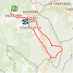

Length
12.5 km

Max alt
1577 m

Uphill gradient
675 m
Km-Effort
22 km

Min alt
946 m

Downhill gradient
725 m
Boucle
No
Creation date :
2018-07-16 20:02:27.595
Updated on :
2018-07-25 08:43:28.308
4h22
Difficulty : Very difficult

FREE GPS app for hiking
 SityTrail
IGN / Geographical institutes
SityTrail Plus
The world is yours!
About
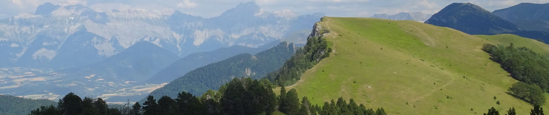
Trail Walking of 12.5 km to be discovered at Auvergne-Rhône-Alpes, Isère, Chichilianne. This trail is proposed by holtzv.
Description
De Richardière à Chichiliane par le Platary_13km_620mPos_670mNeg
Photos

Positioning
Country:
France
Region :
Auvergne-Rhône-Alpes
Department/Province :
Isère
Municipality :
Chichilianne
Location:
Unknown
Start:(Dec)
Start:(UTM)
701588 ; 4966374 (31T) N.
Comments