


Palafour- Aiguille percée

ocepee
User
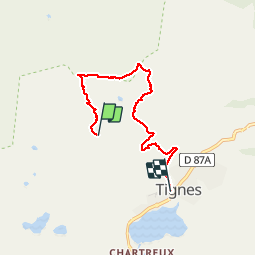

Length
5.2 km

Max alt
2726 m

Uphill gradient
171 m
Km-Effort
9 km

Min alt
2096 m

Downhill gradient
624 m
Boucle
No
Creation date :
2018-08-07 08:17:10.58
Updated on :
2018-08-07 12:18:47.139
2h29
Difficulty : Easy

FREE GPS app for hiking
 SityTrail
IGN / Geographical institutes
SityTrail Plus
The world is yours!
About
Trail Walking of 5.2 km to be discovered at Auvergne-Rhône-Alpes, Savoy, Tignes. This trail is proposed by ocepee.
Description
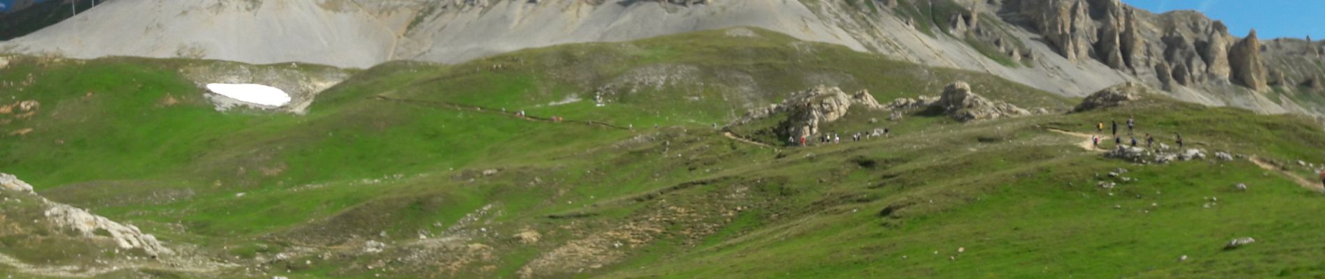
Super rando avec l'occasion de voir pleins de marmottes ! Montée en télésiège et descente à pied !
Photos


Positioning
Country:
France
Region :
Auvergne-Rhône-Alpes
Department/Province :
Savoy
Municipality :
Tignes
Location:
Unknown
Start:(Dec)
Start:(UTM)
335370 ; 5038018 (32T) N.
Comments