


Sainte Victoire - Croix de Provence - pic des Mouches

mhetpierre
User

Length
22 km

Max alt
998 m

Uphill gradient
919 m
Km-Effort
34 km

Min alt
358 m

Downhill gradient
920 m
Boucle
Yes
Creation date :
2018-10-27 08:26:46.648
Updated on :
2018-10-27 08:36:13.684
7h02
Difficulty : Difficult

FREE GPS app for hiking
 SityTrail
IGN / Geographical institutes
SityTrail Plus
The world is yours!
About
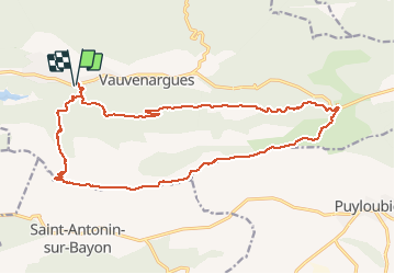
Trail Walking of 22 km to be discovered at Provence-Alpes-Côte d'Azur, Bouches-du-Rhône, Vauvenargues. This trail is proposed by mhetpierre.
Description
Vauvenargues - sentier des Venturiers - croix de Provence - pic des Mouches - col des Portes - Vauvenargues
Positioning
Country:
France
Region :
Provence-Alpes-Côte d'Azur
Department/Province :
Bouches-du-Rhône
Municipality :
Vauvenargues
Location:
Unknown
Start:(Dec)
Start:(UTM)
708606 ; 4825538 (31T) N.
Comments