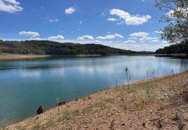
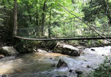
Trail Walking Terre-de-Bancalié - La Vallée Sauvage du Dadou - Photo

La Vallée Sauvage du Dadou

© OpenStreetMap contributors
Length
Length
11.2 km
Max alt
Max alt
452 m
Uphill gradient
Uphill gradient
412 m
Km-Effort
Km-Effort  
16.7 km
Min alt
Min alt
272 m
Downhill gradient
Downhill gradient
413 m
Boucle
Boucle
Yes
Creation date :
2018-12-04 16:46:32.895
Updated on :
2018-12-04 17:04:12.203

(0 Reviews)

Walking
Walking
3h28
Difficulty : Difficult

Scan this QR Code to open this trail in the SityTrail application

FREE GPS app for hiking

Logo SityTrail SityTrail

IGN / Geographical institutes

Download SityTrail from the App Store Download SityTrail from Google Play

Logo SityTrail SityTrail World

The world is yours!

Download SityTrail from the App Store Download SityTrail from Google Play Download SityTrail on Huawei AppGallery

About

Trail Walking of 11.2 km to be discovered at Occitania, Tarn, Terre-de-Bancalié. This trail is proposed by philou6351.

Elevation profile

Points of interest

Point of interest Terre-de-Bancalié - Aire gazonnée avec table de pique-nique - Photo
philou6351
Point of interest Terre-de-Bancalié - Choisir le chemin de droite non balisé - Photo
philou6351
TERRE-DE-BANCALIÉ 
Point of interest Arifat - Ferme la Croix Blanche - Photo
philou6351
Point of interest Arifat - Jonction D13 - Photo
philou6351
ARIFAT 
Point of interest Terre-de-Bancalié - Piquer dans la sente à droite - Photo
philou6351
TERRE-DE-BANCALIÉ 
Point of interest Terre-de-Bancalié - Au lacet, quitter la piste de terre - Photo
philou6351
TERRE-DE-BANCALIÉ 
Point of interest Terre-de-Bancalié - Choisir piste descendant à droite et tout droit  - Photo
philou6351
Point of interest Terre-de-Bancalié - Monter à gauche au lacet - Photo
philou6351
TERRE-DE-BANCALIÉ 
Point of interest Terre-de-Bancalié - Bifurquer à droite - Photo
philou6351
TERRE-DE-BANCALIÉ 
Point of interest Terre-de-Bancalié -  Gourg de la Nauq - Photo
philou6351
TERRE-DE-BANCALIÉ 
Point of interest Terre-de-Bancalié - Traverser le gué et monter à gauche - Photo
philou6351
Point of interest Terre-de-Bancalié - Poursuivre à gauche - Photo
philou6351
TERRE-DE-BANCALIÉ 
Point of interest Terre-de-Bancalié - Monter à droite ignorer les autres pistes  - Photo
philou6351
Point of interest Terre-de-Bancalié - Arrivée au point de départ - Photo
philou6351
TERRE-DE-BANCALIÉ 

Positioning

Country:
France
Region :
Occitania
Department/Province :
Tarn
Municipality :
Terre-de-Bancalié
Location:
Le Travet
Start:(UTM)
446147 ; 4849131 (31T) N.

Trails nearby

Trail Walking Terre-de-Bancalié - Tour du lac de la bancalié - Photo
Walking
tiki01

Walking

Easy
Terre-de-Bancalié, Occitania, Tarn, France
10.2 km | 12.4 km-effort
3h 3min
Yes
Trail Walking Arifat - cascades d'Arifat - Photo
Walking
jpipacific

Walking

Difficult
Arifat, Occitania, Tarn, France
6 km | 9.1 km-effort
1h 58min
Yes
Trail Electric bike Terre-de-Bancalié - Boucle de Roque à Roque - Photo
Electric bike
ktmetarn

Electric bike

Difficult
(1)
Terre-de-Bancalié, Occitania, Tarn, France
29 km | 41 km-effort
Unknown
Yes
Trail Walking Arifat - 81_Arifat_longue_projet - Photo
Walking
jab31

Walking

Medium
Arifat, Occitania, Tarn, France
16.1 km | 24 km-effort
4h 20min
Yes
Trail Walking Arifat - 81_Arifat_Dadounet - Photo
Walking
jab31

Walking

Difficult
(1)
Arifat, Occitania, Tarn, France
15.2 km | 23 km-effort
4h 57min
Yes
Trail Walking Mont-Roc - Rasisse Mont Roc - Photo
Walking
jpipacific

Walking

Medium
Mont-Roc, Occitania, Tarn, France
8.8 km | 12.8 km-effort
2h 32min
Yes
Trail Motor Terre-de-Bancalié - rando 4X4 - Photo
Motor
jpipacific

Motor

Medium
Terre-de-Bancalié, Occitania, Tarn, France
85 km | 118 km-effort
3h 25min
No
Trail Walking Arifat - 81_Saint Paul d'Arifat  - Photo
Walking
jab31

Walking

Medium
Arifat, Occitania, Tarn, France
19.1 km | 27 km-effort
5h 55min
Yes
Trail Walking Arifat - Cascades de Arifat - Photo
Walking
jpipacific

Walking

Medium
Arifat, Occitania, Tarn, France
8.7 km | 13.1 km-effort
2h 39min
Yes


Close
My subscriptions