Trail Walking Larnat - Col de Larnat et Col Doulent - Photo

Col de Larnat et Col Doulent

© OpenStreetMap contributors
Length
Length
14.8 km
Max alt
Max alt
1495 m
Uphill gradient
Uphill gradient
596 m
Km-Effort
Km-Effort  
23 km
Min alt
Min alt
908 m
Downhill gradient
Downhill gradient
596 m
Boucle
Boucle
Yes
Creation date :
2019-02-25 20:51:50.142
Updated on :
2019-07-20 09:42:39.603

(1 Reviews)

Walking
Walking
4h42
Difficulty : Difficult

Scan this QR Code to open this trail in the SityTrail application

FREE GPS app for hiking

Logo SityTrail SityTrail

IGN / Geographical institutes

Download SityTrail from the App Store Download SityTrail from Google Play

Logo SityTrail SityTrail World

The world is yours!

Download SityTrail from the App Store Download SityTrail from Google Play Download SityTrail on Huawei AppGallery

About

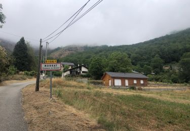
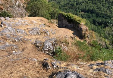
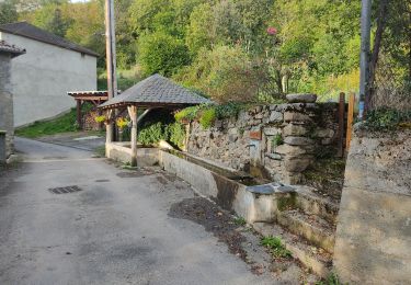
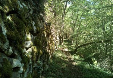
Trail Walking of 14.8 km to be discovered at Occitania, Ariège, Larnat. This trail is proposed by c.chehere.

Elevation profile

Positioning

Country:
France
Region :
Occitania
Department/Province :
Ariège
Municipality :
Larnat
Location:
Unknown
Start:(UTM)
388179 ; 4739450 (31T) N.

Comments

Please log in to post a review or rate the element


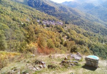
très beaux paysages. parcours sur des pistes presque tout le long


Trails nearby

Trail Electric bike Niaux - Niaux  - Photo
Electric bike
jpborto

Electric bike

Very easy
Niaux, Occitania, Ariège, France
13.8 km | 21 km-effort
51min
Yes
Trail Electric bike Niaux - Château Miglos - Photo
Electric bike
jpborto

Electric bike

Very easy
Niaux, Occitania, Ariège, France
8.1 km | 11 km-effort
45min
No
Trail Walking Miglos - rocher de MIGLOS  - Photo
Walking
chrisgps

Walking

Medium
Miglos, Occitania, Ariège, France
12.8 km | 24 km-effort
6h 50min
Yes
Trail Walking Larnat - Cap de la Lesse - Photo
Walking
c.chehere

Walking

Easy
Larnat, Occitania, Ariège, France
15.5 km | 23 km-effort
5h 41min
Yes
Trail Walking Verdun - Verdun, Albies, Vebre - Photo
Walking
luccio20231

Walking

Easy
Verdun, Occitania, Ariège, France
4.4 km | 6 km-effort
1h 33min
No
Trail Walking Capoulet-et-Junac - Le Vicdessos par Illié - Photo
Walking
c.chehere

Walking

Medium
Capoulet-et-Junac, Occitania, Ariège, France
14.3 km | 24 km-effort
5h 52min
Yes
Trail Walking Niaux - Niaux  - Photo
Walking
c.chehere

Walking

Easy
Niaux, Occitania, Ariège, France
12.2 km | 21 km-effort
3h 20min
Yes
Trail Walking Capoulet-et-Junac - Tour de la bouiche de Gesties - Photo
Walking
c.chehere

Walking

Difficult
Capoulet-et-Junac, Occitania, Ariège, France
17.3 km | 0 m-effort
7h 40min
Yes
Trail Walking Les Cabannes - Camina des Cabannes à Luzenac - Photo
Walking
c.chehere

Walking

Easy
Les Cabannes, Occitania, Ariège, France
8.4 km | 10.6 km-effort
2h 46min
No


Close
My subscriptions