


Lac des grenouilles

frafemi
User

Length
2.9 km

Max alt
2027 m

Uphill gradient
246 m
Km-Effort
5.5 km

Min alt
1771 m

Downhill gradient
24 m
Boucle
No
Creation date :
2014-12-10 00:00:00.0
Updated on :
2014-12-10 00:00:00.0
5m
Difficulty : Very easy

FREE GPS app for hiking
 SityTrail
IGN / Geographical institutes
SityTrail Plus
The world is yours!
About
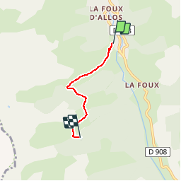
Trail Other activity of 2.9 km to be discovered at Provence-Alpes-Côte d'Azur, Alpes-de-Haute-Provence, Allos. This trail is proposed by frafemi.
Description
Départ télésiège du pon de l'Abrau _ La Foux d'allos
Arrivée lac des grenouilles
Positioning
Country:
France
Region :
Provence-Alpes-Côte d'Azur
Department/Province :
Alpes-de-Haute-Provence
Municipality :
Allos
Location:
Unknown
Start:(Dec)
Start:(UTM)
306174 ; 4906377 (32T) N.
Comments