Allos, Alpes-de-Haute-Provence: Best trails, routes and walks

10 comments

Allos: Discover the best trails: 118 hiking trails and 8 bike and mountain-bike routes. All these trails, routes and outdoor activities are available in our SityTrail applications for smartphones and tablets.


The best trails (141)

Trail Walking Allos - le mont Pelat et le lac du trou de l'aigle - Photo
Walking 14.373
Km
GUIDE

Walking

Medium
Allos, Provence-Alpes-Côte d'Azur, Alpes-de-Haute-Provence, France
14.4 km | 27 km-effort
7h 19min
941 m
941 m
Yes
amiral13

Trail Walking Allos - Allos:rando à partir de la Haute Colette - Photo
Walking 4.025
Km

Walking

Medium
Allos, Provence-Alpes-Côte d'Azur, Alpes-de-Haute-Provence, France
4 km | 7.7 km-effort
3h 48min
273 m
273 m
Yes
halgrain

Trail Walking Allos - 20220822-133204--20220822_GPSLogger - Photo
Walking 10.221
Km

Walking

Very difficult
Allos, Provence-Alpes-Côte d'Azur, Alpes-de-Haute-Provence, France
10.2 km | 19.8 km-effort
4h 29min
719 m
715 m
Yes
diarra

Trail Walking Allos - Col petite Cayolle-21-06-22 - Photo
Walking 11.761
Km

Walking

Medium
Allos, Provence-Alpes-Côte d'Azur, Alpes-de-Haute-Provence, France
11.8 km | 20 km-effort
3h 42min
626 m
625 m
Yes
Christiancordin

Trail Walking Allos - le pelage.lac d'allos - Photo
Walking 15.475
Km

Walking

Very difficult
Allos, Provence-Alpes-Côte d'Azur, Alpes-de-Haute-Provence, France
15.5 km | 28 km-effort
5h 44min
963 m
959 m
Yes
Joel26400

Trail Walking Allos - les lacs de la petite cayolle... - Photo
Walking 30.988
Km

Walking

Easy
Allos, Provence-Alpes-Côte d'Azur, Alpes-de-Haute-Provence, France
31 km | 45 km-effort
6h 45min
810 m
1677 m
No
gibello

Trail Walking Allos - Tête de Sestriere - Photo
Walking 14.416
Km

Walking

Medium
Allos, Provence-Alpes-Côte d'Azur, Alpes-de-Haute-Provence, France
14.4 km | 26 km-effort
6h 52min
904 m
911 m
Yes
ajd26

Trail Walking Allos - lac d allos - Photo
Walking 12.265
Km

Walking

Very easy
Allos, Provence-Alpes-Côte d'Azur, Alpes-de-Haute-Provence, France
12.3 km | 19.8 km-effort
4h 49min
571 m
556 m
Yes
Mariephil

Trail 4x4 Allos - Piste de Bouchier - Photo
4x4 3.59
Km

4x4

Very easy
Allos, Provence-Alpes-Côte d'Azur, Alpes-de-Haute-Provence, France
3.6 km | 5.8 km-effort
Unknown
206 m
49 m
No
pascal06300

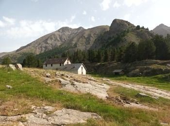
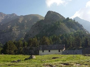
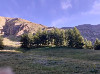
• Jolie petit hameaux au creux des montagnes

Trail Walking Allos - MF de Valdemars - Photo
Walking 14.025
Km

Walking

Medium
Allos, Provence-Alpes-Côte d'Azur, Alpes-de-Haute-Provence, France
14 km | 21 km-effort
4h 24min
540 m
539 m
Yes
LtZIP

Trail Walking Allos - Les Lacs de la Petite Cayolle, des Garrets et d' Allos - Photo
Walking 14.89
Km

Walking

Medium
Allos, Provence-Alpes-Côte d'Azur, Alpes-de-Haute-Provence, France
14.9 km | 24 km-effort
4h 52min
657 m
656 m
Yes
LtZIP

Trail Walking Allos - lacs de la petite Cayolle et des Garrets et montagne de l'Avalanche - Photo
Walking 14.638
Km
GUIDE

Walking

Medium
Allos, Provence-Alpes-Côte d'Azur, Alpes-de-Haute-Provence, France
14.6 km | 24 km-effort
7h 17min
729 m
731 m
Yes
amiral13

Trail Walking Allos - le lac d'Allos - Photo
Walking 8.003
Km
GUIDE

Walking

Very easy
Allos, Provence-Alpes-Côte d'Azur, Alpes-de-Haute-Provence, France
8 km | 11.1 km-effort
4h 2min
232 m
232 m
Yes
amiral13

Trail Walking Allos - tete de la sestriere - Photo
Walking 7.585
Km

Walking

Easy
(1)
Allos, Provence-Alpes-Côte d'Azur, Alpes-de-Haute-Provence, France
7.6 km | 16.6 km-effort
3h 15min
678 m
678 m
Yes
ascq

Trail Walking Allos - Allos -Le Brec - Allos - Photo
Walking 4.696
Km

Walking

Very easy
Allos, Provence-Alpes-Côte d'Azur, Alpes-de-Haute-Provence, France
4.7 km | 6.6 km-effort
1h 25min
134 m
169 m
No
jacobn

Trail Walking Allos - Rochecline - Photo
Walking 12.222
Km

Walking

Difficult
Allos, Provence-Alpes-Côte d'Azur, Alpes-de-Haute-Provence, France
12.2 km | 26 km-effort
3h 21min
1006 m
1005 m
Yes
c100106

Trail Walking Allos - J8TourUbaye - Photo
Walking 15.605
Km

Walking

Very difficult
Allos, Provence-Alpes-Côte d'Azur, Alpes-de-Haute-Provence, France
15.6 km | 24 km-effort
4h 24min
509 m
925 m
No
annehc

Trail Walking Allos - Foux d'Allos - Col et Tête de Sestrière - Photo
Walking 9.487
Km

Walking

Difficult
Allos, Provence-Alpes-Côte d'Azur, Alpes-de-Haute-Provence, France
9.5 km | 18.7 km-effort
3h 8min
689 m
690 m
Yes
LtZIP

Trail Walking Allos - Mont Pelat-Lac du Trou de l'Aigle-Tour du Lac d'Allos - Photo
Walking 19.466
Km

Walking

Very difficult
Allos, Provence-Alpes-Côte d'Azur, Alpes-de-Haute-Provence, France
19.5 km | 33 km-effort
6h 36min
1027 m
1024 m
Yes
donda

Trail Walking Allos - lac d'allos - Photo
Walking 14.778
Km

Walking

Easy
Allos, Provence-Alpes-Côte d'Azur, Alpes-de-Haute-Provence, France
14.8 km | 23 km-effort
5h 45min
621 m
622 m
Yes
jefflesmilles

20 trails displayed on 141

FREE GPS app for hiking

Logo SityTrail SityTrail

IGN / Geographical institutes

Download SityTrail from the App Store Download SityTrail from Google Play

Logo SityTrail SityTrail World

The world is yours!

Download SityTrail from the App Store Download SityTrail from Google Play Download SityTrail on Huawei AppGallery

Activities

Close
My subscriptions