


Millas Forca Réal par Corneilla

Fildesir
User
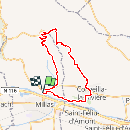

Length
15.5 km

Max alt
502 m

Uphill gradient
460 m
Km-Effort
22 km

Min alt
85 m

Downhill gradient
460 m
Boucle
Yes
Creation date :
2019-03-07 15:47:14.795
Updated on :
2019-03-07 15:49:07.859
4h34
Difficulty : Medium

FREE GPS app for hiking
 SityTrail
IGN / Geographical institutes
SityTrail Plus
The world is yours!
About
Trail Walking of 15.5 km to be discovered at Occitania, Pyrénées-Orientales, Millas. This trail is proposed by Fildesir.
Positioning
Country:
France
Region :
Occitania
Department/Province :
Pyrénées-Orientales
Municipality :
Millas
Location:
Unknown
Start:(Dec)
Start:(UTM)
475154 ; 4727295 (31T) N.
Comments