


La turennoise 2019

christian19
User
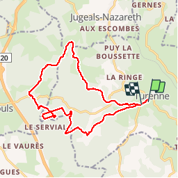

Length
16.9 km

Max alt
359 m

Uphill gradient
330 m
Km-Effort
21 km

Min alt
288 m

Downhill gradient
319 m
Boucle
No
Creation date :
2019-03-17 08:33:17.844
Updated on :
2019-03-17 13:30:26.663
3h29
Difficulty : Medium

FREE GPS app for hiking
 SityTrail
IGN / Geographical institutes
SityTrail Plus
The world is yours!
About
Trail Walking of 16.9 km to be discovered at New Aquitaine, Corrèze, Turenne. This trail is proposed by christian19.
Description
Belle rando mais de la pluie.
Positioning
Country:
France
Region :
New Aquitaine
Department/Province :
Corrèze
Municipality :
Turenne
Location:
Unknown
Start:(Dec)
Start:(UTM)
388157 ; 4989658 (31T) N.
Comments