


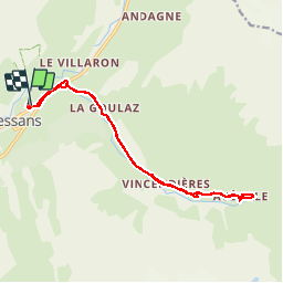
73 - BESSANS

AndreLACOMBE
User

Length
15.9 km

Max alt
2025 m

Uphill gradient
353 m
Km-Effort
21 km

Min alt
1725 m

Downhill gradient
351 m
Boucle
Yes
Creation date :
2019-03-21 08:39:20.484
Updated on :
2019-03-21 14:57:12.181
6h13
Difficulty : Medium

FREE GPS app for hiking
 SityTrail
IGN / Geographical institutes
SityTrail Plus
The world is yours!
About
Trail Walking of 15.9 km to be discovered at Auvergne-Rhône-Alpes, Savoy, Bessans. This trail is proposed by AndreLACOMBE.
Description
De BESSANS à Avérole et retour (à pied sans raquettes).
Positioning
Country:
France
Region :
Auvergne-Rhône-Alpes
Department/Province :
Savoy
Municipality :
Bessans
Location:
Unknown
Start:(Dec)
Start:(UTM)
343166 ; 5020879 (32T) N.
Comments