


3132019

ffdur
User
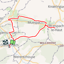

Length
16.4 km

Max alt
459 m

Uphill gradient
279 m
Km-Effort
20 km

Min alt
363 m

Downhill gradient
279 m
Boucle
Yes
Creation date :
2019-03-31 06:26:43.335
Updated on :
2019-03-31 10:07:46.653
3h39
Difficulty : Very easy

FREE GPS app for hiking
 SityTrail
IGN / Geographical institutes
SityTrail Plus
The world is yours!
About
Trail Walking of 16.4 km to be discovered at Grand Est, Haut-Rhin, Durmenach. This trail is proposed by ffdur.
Positioning
Country:
France
Region :
Grand Est
Department/Province :
Haut-Rhin
Municipality :
Durmenach
Location:
Unknown
Start:(Dec)
Start:(UTM)
374914 ; 5264883 (32T) N.
Comments