


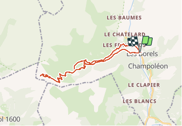
Borels (Champoléon) - Refuge du Tourond - Col de la Vénasque

gilbinrod
User


8h20
Difficulty : Medium

FREE GPS app for hiking
 SityTrail
IGN / Geographical institutes
SityTrail Plus
The world is yours!
About
Trail Walking of 21 km to be discovered at Provence-Alpes-Côte d'Azur, Hautes-Alpes, Champoléon. This trail is proposed by gilbinrod.
Description
Une très belle randonnée : le magnifique cirque du Tourond, la montée rafraichissante dans le mélézin à l'ubac, le passage sur Planure, le paysage depuis le col. Montée l'après-midi au Refuge du Tourond la veille (petite visite à la cascade de la Pisse), avant d'attaquer la montée vers le col le lendemain, puis redescente des 1200m de dénivelé(visite en passant du haut de la cascade).
Positioning
Comments