Champoléon, Hautes-Alpes: Best trails, routes and walks

7 comments

Champoléon: Discover the best trails: 119 hiking trails and 1 bike and mountain-bike routes. All these trails, routes and outdoor activities are available in our SityTrail applications for smartphones and tablets.


The best trails (137)

Trail Walking Champoléon - Balade Vallée Champoléon - Photo
Walking 9.511
Km
GUIDE

Walking

Easy
Champoléon, Provence-Alpes-Côte d'Azur, Hautes-Alpes, France
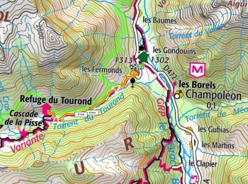
9.5 km | 12.2 km-effort
2h 40min
203 m
202 m
Yes
nadinebondoux

Trail Walking Champoléon - Refuge Tourond + Cascade 28/07/20 - Photo
Walking 9.843
Km
GUIDE

Walking

Difficult
Champoléon, Provence-Alpes-Côte d'Azur, Hautes-Alpes, France
9.8 km | 16.8 km-effort
3h 22min
500 m
587 m
No
R@ph

Trail Walking Champoléon - Lac Surat ou lac de Prelle - Photo
Walking 16.307
Km

Walking

Very difficult
Champoléon, Provence-Alpes-Côte d'Azur, Hautes-Alpes, France
16.3 km | 30 km-effort
6h 50min
1032 m
1032 m
Yes
Marco05

Trail Walking Champoléon - PARC NATIONAL DES ECRINS: LACS DE CRUPILOUSE - Photo
Walking 17.448
Km

Walking

Very difficult
Champoléon, Provence-Alpes-Côte d'Azur, Hautes-Alpes, France
17.4 km | 37 km-effort
7h 24min
1447 m
1446 m
Yes
djeepee74

Trail On foot Champoléon - Refuge du Tourond - Photo
On foot 8.365
Km

On foot

Easy
Champoléon, Provence-Alpes-Côte d'Azur, Hautes-Alpes, France
8.4 km | 14.2 km-effort
3h 14min
440 m
440 m
Yes
Marco05

Trail Walking Champoléon - Méollion - Photo
Walking 7.516
Km

Walking

Medium
Champoléon, Provence-Alpes-Côte d'Azur, Hautes-Alpes, France
7.5 km | 13.7 km-effort
2h 59min
464 m
464 m
Yes
Marco05

Trail Walking Champoléon - Boucle Isora - Photo
Walking 17.832
Km

Walking

Very difficult
Champoléon, Provence-Alpes-Côte d'Azur, Hautes-Alpes, France
17.8 km | 38 km-effort
8h 39min
1522 m
1520 m
Yes
Marco05

Trail Walking Champoléon - 05 - MEOLLION Champsaur - Photo
Walking 8.275
Km

Walking

Medium
Champoléon, Provence-Alpes-Côte d'Azur, Hautes-Alpes, France
8.3 km | 14.9 km-effort
2h 46min
494 m
494 m
Yes
chris13370

Trail Walking Champoléon - Village de Méollion.26/10/20. - Photo
Walking 6.432
Km

Walking

Easy
Champoléon, Provence-Alpes-Côte d'Azur, Hautes-Alpes, France
6.4 km | 12 km-effort
2h 21min
414 m
417 m
Yes
Dervalmarc

Trail Walking Champoléon - 20190514_Les Fermonds_Refuge du Tourond_Les Bouquetins - Photo
Walking 10.341
Km

Walking

Medium
Champoléon, Provence-Alpes-Côte d'Azur, Hautes-Alpes, France
10.3 km | 19.7 km-effort
5h 36min
701 m
697 m
Yes
PapouBertrand

Trail Walking Champoléon - Valestreche et le Gourette depuis les Beaumes. 01/05/19. - Photo
Walking 11.111
Km

Walking

Difficult
Champoléon, Provence-Alpes-Côte d'Azur, Hautes-Alpes, France
11.1 km | 22 km-effort
4h 29min
842 m
864 m
No
Dervalmarc

Trail Walking Champoléon - Refuge du Pré de la Chaumette.(09-10-16) - Photo
Walking 10.373
Km

Walking

Easy
Champoléon, Provence-Alpes-Côte d'Azur, Hautes-Alpes, France
10.4 km | 15.2 km-effort
2h 58min
361 m
365 m
Yes
Dervalmarc

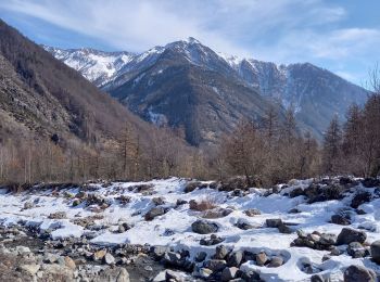
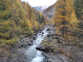
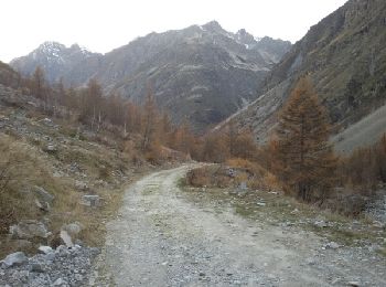
• Très belle rando automnale.Luminosité et couleur remarquable en cette saison.

Trail Walking Champoléon - lac de  Prelle.  col du petit cheval de bois.(11-11-15)  - Photo
Walking 16.605
Km

Walking

Difficult
Champoléon, Provence-Alpes-Côte d'Azur, Hautes-Alpes, France
16.6 km | 31 km-effort
6h 45min
1046 m
1051 m
Yes
Dervalmarc

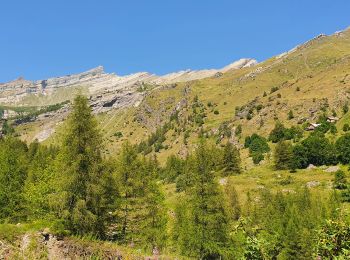
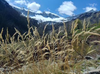
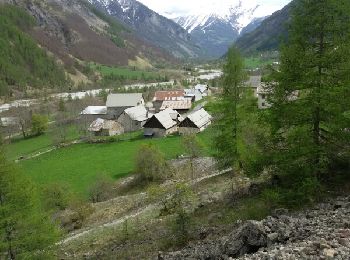
• Très longue randonnée. Pas de difficultés particulières.

Trail Walking Champoléon - Cabane et vallon de Vallestreche - Photo
Walking 8.169
Km

Walking

Medium
(1)
Champoléon, Provence-Alpes-Côte d'Azur, Hautes-Alpes, France
8.2 km | 16.7 km-effort
3h 35min
641 m
640 m
Yes
Dervalmarc

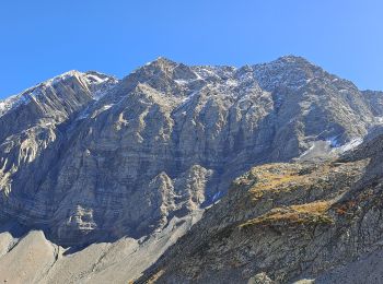
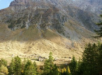
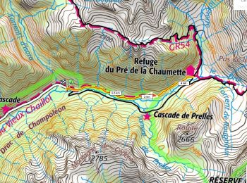
• passage du verrou exposé et très raide . Peut présenter une réelle difficulté en début de saison. Faune sauvage abond...

Trail Walking Champoléon - Pré de la Chaumette depuis Les Auberts (Champoléon) - Photo
Walking 9.278
Km

Walking

Easy
(1)
Champoléon, Provence-Alpes-Côte d'Azur, Hautes-Alpes, France
9.3 km | 14.1 km-effort
3h 2min
363 m
364 m
Yes
gilbinrod

Trail Walking Champoléon - Ref du Tourond D+325m depuis les Fermonds - Photo
Walking 6.081
Km

Walking

Medium
Champoléon, Provence-Alpes-Côte d'Azur, Hautes-Alpes, France
6.1 km | 10.4 km-effort
2h 22min
326 m
326 m
Yes
ericberlin

Trail Walking Champoléon - Ref du pré de la Chaumette D+345m depuis P des Auberts - Photo
Walking 7.592
Km

Walking

Difficult
Champoléon, Provence-Alpes-Côte d'Azur, Hautes-Alpes, France
7.6 km | 12.1 km-effort
2h 45min
339 m
344 m
Yes
ericberlin

Trail Walking Champoléon - refuge du Tourrond - Photo
Walking 7.937
Km

Walking

Easy
Champoléon, Provence-Alpes-Côte d'Azur, Hautes-Alpes, France
7.9 km | 13.5 km-effort
2h 36min
420 m
419 m
Yes
marchev

Trail Walking Champoléon - pk les Auberts refuge Vallonpierre  - Photo
Walking 16.553
Km

Walking

Medium
Champoléon, Provence-Alpes-Côte d'Azur, Hautes-Alpes, France
16.6 km | 35 km-effort
6h 44min
1615 m
812 m
No
ajpbm

Trail Walking Champoléon - Refuge au pré Chaumette - Photo
Walking 42.176
Km

Walking

Medium
Champoléon, Provence-Alpes-Côte d'Azur, Hautes-Alpes, France
42 km | 55 km-effort
3h 30min
898 m
1026 m
No
jlouisvideo

20 trails displayed on 137

FREE GPS app for hiking

Logo SityTrail SityTrail

IGN / Geographical institutes

Download SityTrail from the App Store Download SityTrail from Google Play

Logo SityTrail SityTrail World

The world is yours!

Download SityTrail from the App Store Download SityTrail from Google Play Download SityTrail on Huawei AppGallery

Activities

Close
My subscriptions