


GR65 De Larribar-Sorhapuru (Pyrénées-Atlantiques) à Roncesvalles (Espagne) (2016)

phimar_2612
User
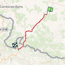

Length
56 km

Max alt
1427 m

Uphill gradient
2203 m
Km-Effort
83 km

Min alt
64 m

Downhill gradient
1364 m
Boucle
No
Creation date :
2019-04-13 08:24:09.763
Updated on :
2019-04-13 08:24:31.127
17h46
Difficulty : Very difficult

FREE GPS app for hiking
 SityTrail
IGN / Geographical institutes
SityTrail Plus
The world is yours!
About
Trail Walking of 56 km to be discovered at New Aquitaine, Pyrénées-Atlantiques, Larribar-Sorhapuru. This trail is proposed by phimar_2612.
Positioning
Country:
France
Region :
New Aquitaine
Department/Province :
Pyrénées-Atlantiques
Municipality :
Larribar-Sorhapuru
Location:
Unknown
Start:(Dec)
Start:(UTM)
661223 ; 4795239 (30T) N.
Comments