Trail Walking Saint-Étienne-Roilaye - en forêt de Compiègne_27_la Tournante sur la Côte de Roilaye - Photo

en forêt de Compiègne_27_la Tournante sur la Côte de Roilaye

mes randos en forêt

© OpenStreetMap contributors
Length
Length
3.8 km
Max alt
Max alt
142 m
Uphill gradient
Uphill gradient
85 m
Km-Effort
Km-Effort  
4.9 km
Min alt
Min alt
77 m
Downhill gradient
Downhill gradient
88 m
Boucle
Boucle
Yes
Creation date :
2019-04-18 07:19:28.0
Updated on :
2021-09-19 14:52:03.766

(0 Reviews)

Walking
Walking
1h05
Difficulty : Very difficult

Scan this QR Code to open this trail in the SityTrail application

FREE GPS app for hiking

Logo SityTrail SityTrail

IGN / Geographical institutes

Download SityTrail from the App Store Download SityTrail from Google Play

Logo SityTrail SityTrail World

The world is yours!

Download SityTrail from the App Store Download SityTrail from Google Play Download SityTrail on Huawei AppGallery

About

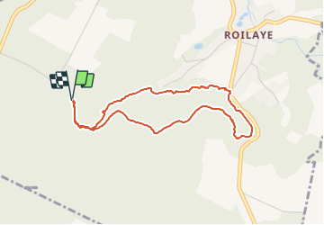
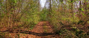
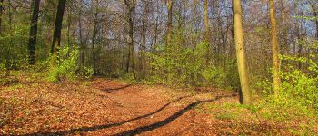
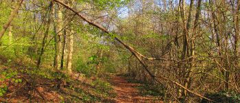
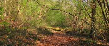
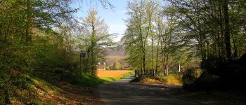
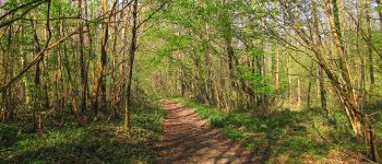
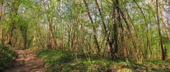
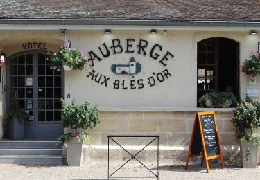
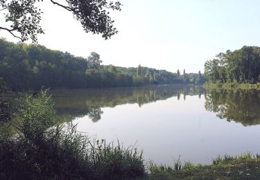
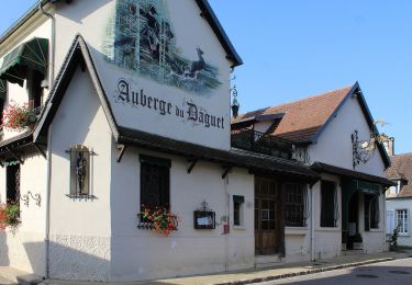
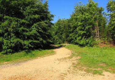
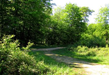
Trail Walking of 3.8 km to be discovered at Hauts-de-France, Oise, Saint-Étienne-Roilaye. This trail is proposed by en forêt de Compiègne.

Description

voir aussi: la-foret-de-compiegne.fr/

Objectif: faire complètement cette Tournante, ce qui ne fut pas le cas avec la rando intitulée: en forêt de Compiègne_26_la Grotte des Ramoneurs_Tournantes  de la Queue de Saint-Etienne et sur la Côte de Roilaye.

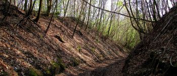
warning: en remontant la côte  au niveau de la Rue la Briquetterie, chemin visible mais qui disparaît rapidement avec la végétation (ronces, herbes aquatiques, gaulis): très difficile à pratiquer. D'autre part, sur cette partie de la côte, les cartes IGN sont fausses. Et une portion de route bitumée est visible au bout de la Rue du Trou à Loup qui ne figure pas sur les cartes IGN.

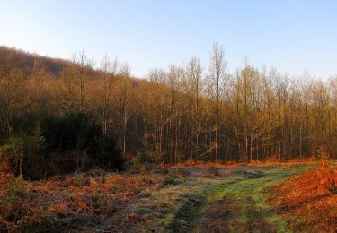
Pour la description, voir mon tracé pour faire cette Tournante sur la Côte de Roilaye.
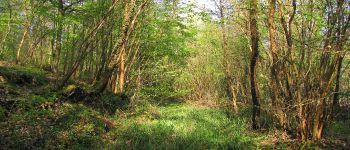
Si c'était à refaire, je pense qu'il vaudrait mieux la refaire à l'envers en partant du même point de départ mais en descendant plutôt qu'en montant. En descendant, il y a un chemin (je l'ai retrouvé en montant à mi-parcours de la remontée, voir s'il disparaît à un moment?).

Elevation profile

Photos

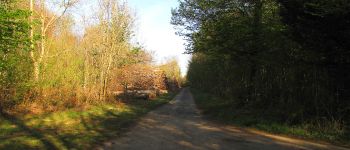
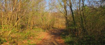
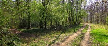
70 photos in total. Please click on a photo to see them all in the gallery.

Points of interest

Point of interest Saint-Étienne-Roilaye - Départ et Arrivée - Photo
JeanLucA4
SAINT-ÉTIENNE-ROILAYE 
Point of interest Saint-Étienne-Roilaye - Point 1 - Photo
JeanLucA4
SAINT-ÉTIENNE-ROILAYE 
Point of interest Saint-Étienne-Roilaye - Point 2 - Photo
JeanLucA4
SAINT-ÉTIENNE-ROILAYE 
Point of interest Saint-Étienne-Roilaye - Point 3 - Photo
JeanLucA4
SAINT-ÉTIENNE-ROILAYE 
Point of interest Saint-Étienne-Roilaye - Point 4 - Photo
JeanLucA4
SAINT-ÉTIENNE-ROILAYE 
Point of interest Saint-Étienne-Roilaye - Point 5 - Photo
JeanLucA4
SAINT-ÉTIENNE-ROILAYE 
Point of interest Saint-Étienne-Roilaye - Point 6 - Photo
JeanLucA4
SAINT-ÉTIENNE-ROILAYE 
Point of interest Saint-Étienne-Roilaye - Point 2 - Photo
JeanLucA4
SAINT-ÉTIENNE-ROILAYE 
Point of interest Saint-Étienne-Roilaye - Point 7 - Photo
JeanLucA4
SAINT-ÉTIENNE-ROILAYE 
Point of interest Saint-Étienne-Roilaye - Point 8 - Photo
JeanLucA4
SAINT-ÉTIENNE-ROILAYE 
Point of interest Saint-Étienne-Roilaye - Point 9 - Photo
JeanLucA4
SAINT-ÉTIENNE-ROILAYE 
Point of interest Saint-Étienne-Roilaye - Point 10 - Photo
JeanLucA4
SAINT-ÉTIENNE-ROILAYE 
Point of interest Saint-Étienne-Roilaye - Point 11 - Photo
JeanLucA4
SAINT-ÉTIENNE-ROILAYE 
Point of interest Saint-Étienne-Roilaye - Point 12 - Photo
JeanLucA4
SAINT-ÉTIENNE-ROILAYE 
Point of interest Saint-Étienne-Roilaye - Point 13 - Photo
JeanLucA4
SAINT-ÉTIENNE-ROILAYE 
Point of interest Saint-Étienne-Roilaye - Point 14 - Photo
JeanLucA4
SAINT-ÉTIENNE-ROILAYE 

Positioning

Country:
France
Region :
Hauts-de-France
Department/Province :
Oise
Municipality :
Saint-Étienne-Roilaye
Location:
Unknown
Start:(UTM)
500151 ; 5467972 (31U) N.

Trails nearby

Trail On foot Pierrefonds - Le Voliard - Photo
On foot
PRO

On foot

Easy
(1)
Pierrefonds, Hauts-de-France, Oise, France
5.2 km | 6.4 km-effort
1h 27min
No
Trail Walking Pierrefonds - Rando couscous ATPC ARVAL 4/2/2024 - Photo
Walking
pascha

Walking

Medium
(1)
Pierrefonds, Hauts-de-France, Oise, France
9.6 km | 11.9 km-effort
2h 42min
Yes
Trail Walking Vieux-Moulin - Gorges du Han - ATPC ARVAL - Photo
Walking
pascha

Walking

Very easy
(1)
Vieux-Moulin, Hauts-de-France, Oise, France
13.2 km | 16 km-effort
2h 42min
Yes
Trail On foot Trosly-Breuil - Le Mont-Collet - Photo
On foot
PRO

On foot

Easy
Trosly-Breuil, Hauts-de-France, Oise, France
4.9 km | 6.6 km-effort
1h 29min
Yes
Trail On foot Vieux-Moulin - Promenade de Vieux moulin - Photo
On foot
PRO

On foot

Easy
Vieux-Moulin, Hauts-de-France, Oise, France
5.3 km | 7.4 km-effort
1h 40min
Yes
Trail Walking Vieux-Moulin - Gorges du Han  - Photo
Walking
pascha

Walking

Very easy
(1)
Vieux-Moulin, Hauts-de-France, Oise, France
11.5 km | 13.8 km-effort
2h 42min
Yes
Trail Walking Pierrefonds - en forêt de Compiègne_30_la Tournante sous le Mont Saint-Mard - Photo
Walking

Walking

Very difficult
Pierrefonds, Hauts-de-France, Oise, France
17.8 km | 22 km-effort
4h 41min
Yes
Trail Walking Trosly-Breuil - en forêt de Compiègne_28_les Tournantes sur le Mont Saint-Mard et sur le Mont Collet - Photo
Walking

Walking

Difficult
(1)
Trosly-Breuil, Hauts-de-France, Oise, France
13.8 km | 16.1 km-effort
3h 46min
Yes
Trail Walking Vieux-Moulin - en forêt de Compiègne_26_la Grotte des Ramoneurs_Tournantes de la Queue de Saint-Etienne et sur la Côte de Roilaye - Photo
Walking

Walking

Difficult
Vieux-Moulin, Hauts-de-France, Oise, France
16.1 km | 18.6 km-effort
5h 28min
Yes


Close
My subscriptions