Villar-Loubière / Souffles / La Chapelle en Valgaudemar
gilbinrod
User
Length
20 km
Max alt
2406 m
Uphill gradient
1408 m
Km-Effort
39 km
Min alt
1028 m
Downhill gradient
1414 m
Boucle
Yes
Creation date :
2017-07-30 00:00:00.0
Updated on :
2017-07-30 00:00:00.0
7h49
Difficulty : Medium
FREE GPS app for hiking
About
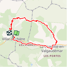
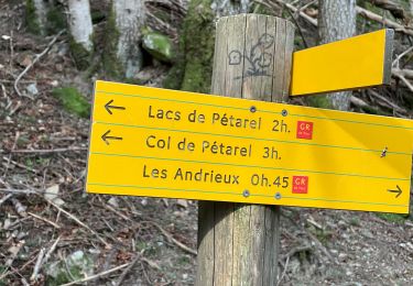
Trail Walking of 20 km to be discovered at Provence-Alpes-Côte d'Azur, Hautes-Alpes, Villar-Loubière. This trail is proposed by gilbinrod.
Description
Montée la veille au refuge des Souffles (2h30 montée). Gardien sympathique, spécialités marocaines !
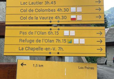
Le lendemain, retour par la Chapelle (regret de ne pas être passé par l'Olan...).
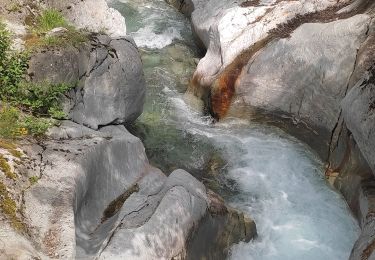
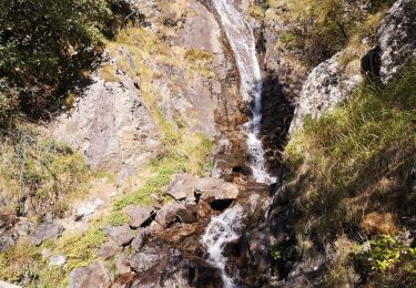
Petit bain et toilette dans la rivière avant de remonter à Villar.
Positioning
Country:
France
Region :
Provence-Alpes-Côte d'Azur
Department/Province :
Hautes-Alpes
Municipality :
Villar-Loubière
Location:
Unknown
Start:(Dec)
Start:(UTM)
274250 ; 4967599 (32T) N.
Comments
Trails nearby
circuit de la cabane de l'aup .08-06-14
Walking
Very easy
(1)
La Chapelle-en-Valgaudémar,
Provence-Alpes-Côte d'Azur,
Hautes-Alpes,
France
8.8 km | 13.6 km-effort
2h 37min
Yes
Les Portes , Les cascades.
Walking
Medium
La Chapelle-en-Valgaudémar,
Provence-Alpes-Côte d'Azur,
Hautes-Alpes,
France
8.1 km | 11 km-effort
2h 25min
Yes
Lacs de Pétarel-Col de la Béranne
Walking
Medium
La Chapelle-en-Valgaudémar,
Provence-Alpes-Côte d'Azur,
Hautes-Alpes,
France
11.1 km | 23 km-effort
7h 0min
Yes
Pas de l'Olan
Walking
Very difficult
La Chapelle-en-Valgaudémar,
Provence-Alpes-Côte d'Azur,
Hautes-Alpes,
France
12.6 km | 34 km-effort
7h 37min
Yes
Valgo2 - J2 : Col de Pétarel
Walking
Very difficult
La Chapelle-en-Valgaudémar,
Provence-Alpes-Côte d'Azur,
Hautes-Alpes,
France
18.8 km | 38 km-effort
5h 40min
No
Valgo2 - J1 : Col des Clochettes
Walking
Difficult
Villar-Loubière,
Provence-Alpes-Côte d'Azur,
Hautes-Alpes,
France
14.6 km | 30 km-effort
4h 12min
Yes
Les Lacs de Pétarel
Walking
Difficult
La Chapelle-en-Valgaudémar,
Provence-Alpes-Côte d'Azur,
Hautes-Alpes,
France
12.5 km | 27 km-effort
5h 43min
Yes
Cime de Turbat.
Walking
Difficult
Villar-Loubière,
Provence-Alpes-Côte d'Azur,
Hautes-Alpes,
France
15.1 km | 32 km-effort
7h 31min
No
Refuge des souffles.
Walking
Medium
Villar-Loubière,
Provence-Alpes-Côte d'Azur,
Hautes-Alpes,
France
4.5 km | 13.7 km-effort
2h 1min
No