


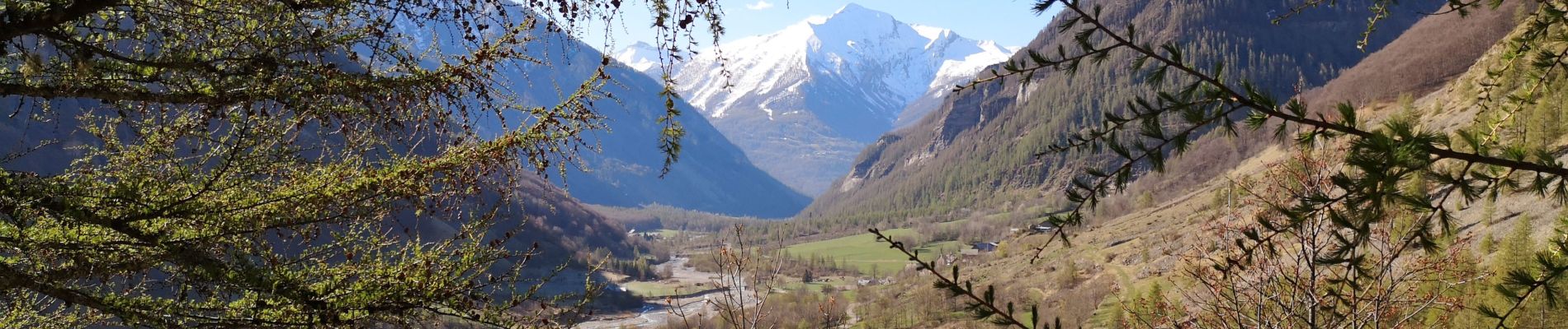
Valestreche et le Gourette depuis les Beaumes. 01/05/19.

Dervalmarc
User
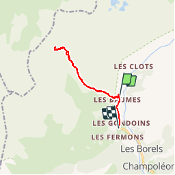

Length
11.1 km

Max alt
2189 m

Uphill gradient
842 m
Km-Effort
22 km

Min alt
1317 m

Downhill gradient
864 m
Boucle
No
Creation date :
2019-05-01 07:19:55.545
Updated on :
2019-05-01 13:42:56.381
4h29
Difficulty : Difficult

FREE GPS app for hiking
 SityTrail
IGN / Geographical institutes
SityTrail Plus
The world is yours!
About
Trail Walking of 11.1 km to be discovered at Provence-Alpes-Côte d'Azur, Hautes-Alpes, Champoléon. This trail is proposed by Dervalmarc.
Description
Rando facile dans un vallon sauvage.
Propice à l'observation des chamois et Bouquetins.
Difficile à partir du couloir de Gourette..
Photos


Positioning
Country:
France
Region :
Provence-Alpes-Côte d'Azur
Department/Province :
Hautes-Alpes
Municipality :
Champoléon
Location:
Unknown
Start:(Dec)
Start:(UTM)
282180 ; 4957703 (32T) N.
Comments