


Villar Loubière - Ref. Souffles

gilbinrod
User
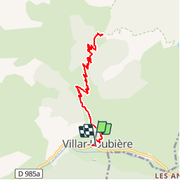

Length
9.9 km

Max alt
1964 m

Uphill gradient
917 m
Km-Effort
22 km

Min alt
1030 m

Downhill gradient
927 m
Boucle
Yes
Creation date :
2014-12-10 00:00:00.0
Updated on :
2014-12-10 00:00:00.0
4h21
Difficulty : Medium

FREE GPS app for hiking
 SityTrail
IGN / Geographical institutes
SityTrail Plus
The world is yours!
About
Trail Walking of 9.9 km to be discovered at Provence-Alpes-Côte d'Azur, Hautes-Alpes, Villar-Loubière. This trail is proposed by gilbinrod.
Positioning
Country:
France
Region :
Provence-Alpes-Côte d'Azur
Department/Province :
Hautes-Alpes
Municipality :
Villar-Loubière
Location:
Unknown
Start:(Dec)
Start:(UTM)
274248 ; 4967588 (32T) N.
Comments