


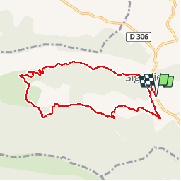
Tour des Michons départ Sigottier

claude nier
User

Length
9.2 km

Max alt
1070 m

Uphill gradient
353 m
Km-Effort
14 km

Min alt
719 m

Downhill gradient
356 m
Boucle
Yes
Creation date :
2019-05-05 11:30:11.29
Updated on :
2019-05-05 15:18:05.566
2h37
Difficulty : Easy

FREE GPS app for hiking
 SityTrail
IGN / Geographical institutes
SityTrail Plus
The world is yours!
About
Trail Walking of 9.2 km to be discovered at Provence-Alpes-Côte d'Azur, Hautes-Alpes, Sigottier. This trail is proposed by claude nier.
Description
Reco avec Alinou
balade très sympa
2h30...9,2 kms...353 mts
Positioning
Country:
France
Region :
Provence-Alpes-Côte d'Azur
Department/Province :
Hautes-Alpes
Municipality :
Sigottier
Location:
Unknown
Start:(Dec)
Start:(UTM)
714364 ; 4925586 (31T) N.
Comments