


Ste Colombe de la commanderie

Yannick.Boireau
User
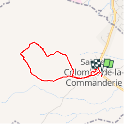

Length
3.6 km

Max alt
228 m

Uphill gradient
78 m
Km-Effort
4.7 km

Min alt
155 m

Downhill gradient
77 m
Boucle
Yes
Creation date :
2019-05-08 14:15:57.869
Updated on :
2019-05-08 16:02:41.606
1h45
Difficulty : Very easy

FREE GPS app for hiking
 SityTrail
IGN / Geographical institutes
SityTrail Plus
The world is yours!
About
Trail Walking of 3.6 km to be discovered at Occitania, Pyrénées-Orientales, Sainte-Colombe-de-la-Commanderie. This trail is proposed by Yannick.Boireau.
Positioning
Country:
France
Region :
Occitania
Department/Province :
Pyrénées-Orientales
Municipality :
Sainte-Colombe-de-la-Commanderie
Location:
Unknown
Start:(Dec)
Start:(UTM)
479405 ; 4718019 (31T) N.
Comments