


Banyuls vers cerbère

nandaf
User

Length
6.3 km

Max alt
158 m

Uphill gradient
218 m
Km-Effort
9.2 km

Min alt
8 m

Downhill gradient
211 m
Boucle
Yes
Creation date :
2019-05-14 12:37:20.0
Updated on :
2024-03-13 16:50:24.429
2h05
Difficulty : Medium

FREE GPS app for hiking
 SityTrail
IGN / Geographical institutes
SityTrail Plus
The world is yours!
About
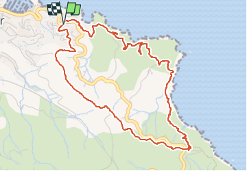
Trail Walking of 6.3 km to be discovered at Occitania, Pyrénées-Orientales, Banyuls-sur-Mer. This trail is proposed by nandaf.
Positioning
Country:
France
Region :
Occitania
Department/Province :
Pyrénées-Orientales
Municipality :
Banyuls-sur-Mer
Location:
Unknown
Start:(Dec)
Start:(UTM)
511545 ; 4702981 (31T) N.
Comments