


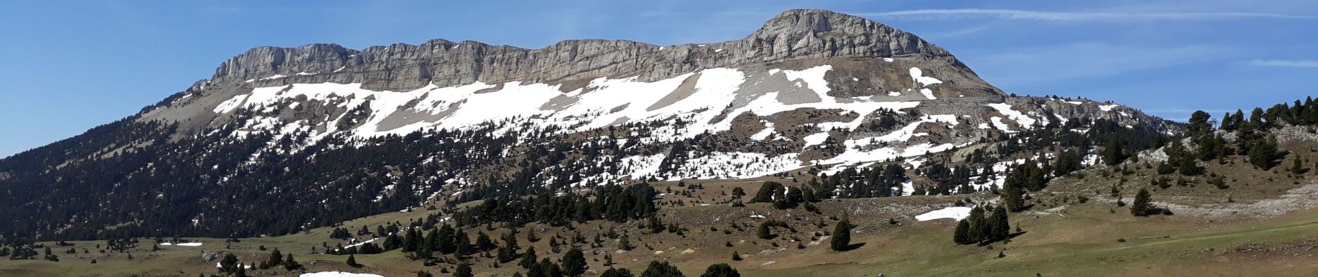
tete de chevaliere

gibello
User
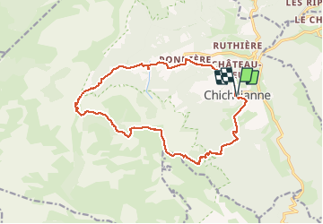

Length
17.1 km

Max alt
1946 m

Uphill gradient
1077 m
Km-Effort
31 km

Min alt
985 m

Downhill gradient
1076 m
Boucle
Yes
Creation date :
2019-05-23 06:26:55.605
Updated on :
2019-05-23 14:02:35.997
7h00
Difficulty : Difficult

FREE GPS app for hiking
 SityTrail
IGN / Geographical institutes
SityTrail Plus
The world is yours!
About
Trail Walking of 17.1 km to be discovered at Auvergne-Rhône-Alpes, Isère, Chichilianne. This trail is proposed by gibello.
Description
départ chichilianne
Photos

Positioning
Country:
France
Region :
Auvergne-Rhône-Alpes
Department/Province :
Isère
Municipality :
Chichilianne
Location:
Unknown
Start:(Dec)
Start:(UTM)
703490 ; 4965197 (31T) N.
Comments