Trail On foot Corrençon-en-Vercors - chateau julien, herbouilly, retour pas de l'ane - Photo

chateau julien, herbouilly, retour pas de l'ane

© OpenStreetMap contributors
Length
Length
15.3 km
Max alt
Max alt
1533 m
Uphill gradient
Uphill gradient
615 m
Km-Effort
Km-Effort  
24 km
Min alt
Min alt
1143 m
Downhill gradient
Downhill gradient
613 m
Boucle
Boucle
Yes
Creation date :
2019-05-27 18:45:02.28
Updated on :
2019-05-27 18:50:49.224

(0 Reviews)

On foot
On foot
--
Difficulty : Very easy

Scan this QR Code to open this trail in the SityTrail application

FREE GPS app for hiking

Logo SityTrail SityTrail

IGN / Geographical institutes

Download SityTrail from the App Store Download SityTrail from Google Play

Logo SityTrail SityTrail Plus

The world is yours!

Download SityTrail from the App Store Download SityTrail from Google Play Download SityTrail on Huawei AppGallery

About

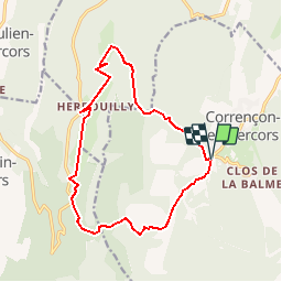
Trail On foot of 15.3 km to be discovered at Auvergne-Rhône-Alpes, Isère, Corrençon-en-Vercors. This trail is proposed by nouailletas.

Description

départ de correncon hauts  plateaux,  campalong, pré Pansu , scialet et passerelle de Malaterre , bélvédere de chateau julien , le fond du riou, belvédère d'herbouilly , les fermes par la plaine, pot du loup  descente dans le scialet, roybon, pas de l'ane, fleur du roy retour correncon

Elevation profile

Positioning

Country:
France
Region :
Auvergne-Rhône-Alpes
Department/Province :
Isère
Municipality :
Corrençon-en-Vercors
Location:
Unknown
Start:(UTM)
698348 ; 4988725 (31T) N.


Close
My subscriptions