


Col de Saumane et Col du Barret depart Sigottier

claude nier
User
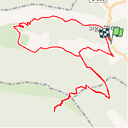

Length
16.1 km

Max alt
1354 m

Uphill gradient
906 m
Km-Effort
28 km

Min alt
717 m

Downhill gradient
906 m
Boucle
Yes
Creation date :
2019-05-28 10:55:34.481
Updated on :
2019-05-28 10:56:47.512
5h42
Difficulty : Very difficult

FREE GPS app for hiking
 SityTrail
IGN / Geographical institutes
SityTrail Plus
The world is yours!
About
Trail Walking of 16.1 km to be discovered at Provence-Alpes-Côte d'Azur, Hautes-Alpes, Sigottier. This trail is proposed by claude nier.
Description
2 beaux cols....
Positioning
Country:
France
Region :
Provence-Alpes-Côte d'Azur
Department/Province :
Hautes-Alpes
Municipality :
Sigottier
Location:
Unknown
Start:(Dec)
Start:(UTM)
714388 ; 4925535 (31T) N.
Comments