


Tête de Pradieu par le Pas d'Anna Falque (18 km - D. 1173 m)

Thomasdanielle
User
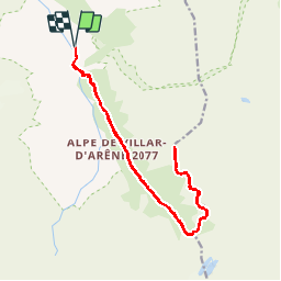

Length
17.7 km

Max alt
2857 m

Uphill gradient
1173 m
Km-Effort
33 km

Min alt
1720 m

Downhill gradient
1170 m
Boucle
Yes
Creation date :
2019-05-29 16:37:47.968
Updated on :
2019-05-29 16:47:28.718
4h46
Difficulty : Difficult

FREE GPS app for hiking
 SityTrail
IGN / Geographical institutes
SityTrail Plus
The world is yours!
About
Trail Walking of 17.7 km to be discovered at Provence-Alpes-Côte d'Azur, Hautes-Alpes, Villar-d'Arêne. This trail is proposed by Thomasdanielle.
Description
Aller/Retour Parkin du Monêtier-Les-Bains, remonter le col du Lautaret puis descendre vers Villars-d'Arêne.
Positioning
Country:
France
Region :
Provence-Alpes-Côte d'Azur
Department/Province :
Hautes-Alpes
Municipality :
Villar-d'Arêne
Location:
Unknown
Start:(Dec)
Start:(UTM)
292928 ; 4988501 (32T) N.
Comments