


Rivière Saas et GOURBY 2

bitiba
User
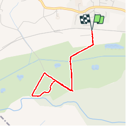

Length
3.7 km

Max alt
10 m

Uphill gradient
13 m
Km-Effort
3.9 km

Min alt
3 m

Downhill gradient
14 m
Boucle
Yes
Creation date :
2019-05-30 11:54:40.0
Updated on :
2019-05-30 13:22:03.164
1h26
Difficulty : Unknown

FREE GPS app for hiking
 SityTrail
IGN / Geographical institutes
SityTrail Plus
The world is yours!
About
Trail Walking of 3.7 km to be discovered at New Aquitaine, Landes, Rivière-Saas-et-Gourby. This trail is proposed by bitiba.
Description
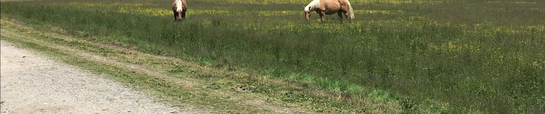
Le 30 Mai promenade surprenante avec un bain de boue dans les Barthes très beau temps beaucoup de chevaux et cigognes
Photos


Positioning
Country:
France
Region :
New Aquitaine
Department/Province :
Landes
Municipality :
Rivière-Saas-et-Gourby
Location:
Unknown
Start:(Dec)
Start:(UTM)
649036 ; 4837641 (30T) N.
Comments