


refuge de l'Orgère

laurentnecca
User
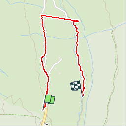

Length
1.9 km

Max alt
1972 m

Uphill gradient
19 m
Km-Effort
2.3 km

Min alt
1907 m

Downhill gradient
66 m
Boucle
No
Creation date :
2019-06-03 08:30:49.812
Updated on :
2019-06-03 12:49:00.005
50m
Difficulty : Easy

FREE GPS app for hiking
 SityTrail
IGN / Geographical institutes
SityTrail Plus
The world is yours!
About
Trail Walking of 1.9 km to be discovered at Auvergne-Rhône-Alpes, Savoy, Villarodin-Bourget. This trail is proposed by laurentnecca.
Positioning
Country:
France
Region :
Auvergne-Rhône-Alpes
Department/Province :
Savoy
Municipality :
Villarodin-Bourget
Location:
Unknown
Start:(Dec)
Start:(UTM)
317308 ; 5011148 (32T) N.
Comments