


ST-HIPPOLYTE

Corsica76
User
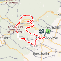

Length
15.7 km

Max alt
676 m

Uphill gradient
620 m
Km-Effort
24 km

Min alt
248 m

Downhill gradient
619 m
Boucle
Yes
Creation date :
2019-06-03 19:30:21.299
Updated on :
2019-06-03 19:31:48.133
4h58
Difficulty : Very difficult

FREE GPS app for hiking
 SityTrail
IGN / Geographical institutes
SityTrail Plus
The world is yours!
About
Trail Walking of 15.7 km to be discovered at Grand Est, Haut-Rhin, Saint-Hippolyte. This trail is proposed by Corsica76.
Positioning
Country:
France
Region :
Grand Est
Department/Province :
Haut-Rhin
Municipality :
Saint-Hippolyte
Location:
Unknown
Start:(Dec)
Start:(UTM)
378763 ; 5343546 (32U) N.
Comments