


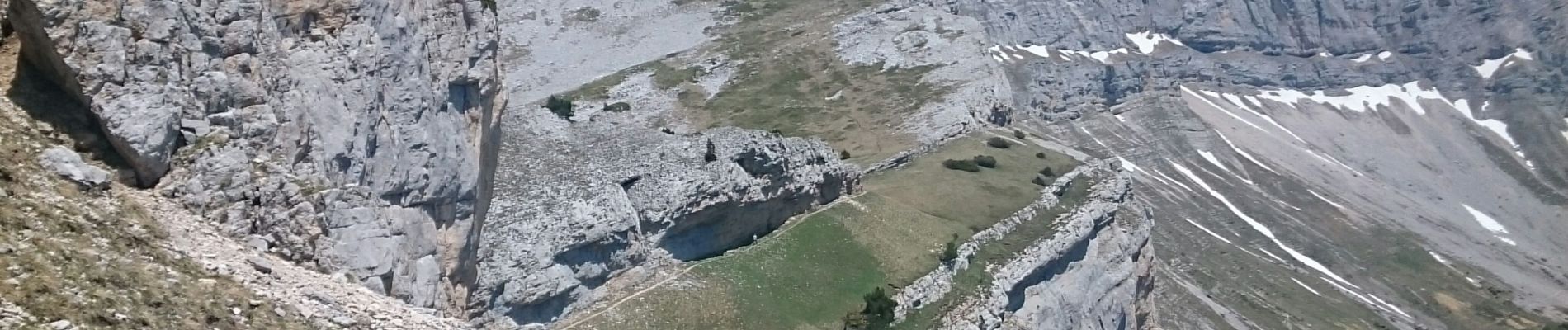
Têtes des Chaudières

Michel_Martin
User

Length
15.4 km

Max alt
2048 m

Uphill gradient
1142 m
Km-Effort
31 km

Min alt
1234 m

Downhill gradient
1146 m
Boucle
Yes
Creation date :
2019-06-04 07:37:08.111
Updated on :
2021-04-08 14:58:50.193
6h37
Difficulty : Medium

FREE GPS app for hiking
 SityTrail
IGN / Geographical institutes
SityTrail Plus
The world is yours!
About
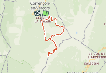
Trail Walking of 15.4 km to be discovered at Auvergne-Rhône-Alpes, Isère, Corrençon-en-Vercors. This trail is proposed by Michel_Martin.
Photos


Positioning
Country:
France
Region :
Auvergne-Rhône-Alpes
Department/Province :
Isère
Municipality :
Corrençon-en-Vercors
Location:
Unknown
Start:(Dec)
Start:(UTM)
699296 ; 4988247 (31T) N.
Comments