


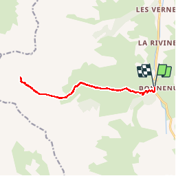
La Combe des Aiguilles d'Arves (13 km - D. 947 m)

Thomasdanielle
User


--
Difficulty : Medium

FREE GPS app for hiking
 SityTrail
IGN / Geographical institutes
SityTrail Plus
The world is yours!
About
Trail On foot of 13 km to be discovered at Auvergne-Rhône-Alpes, Savoy, Valloire. This trail is proposed by Thomasdanielle.
Description
Stationner au grand parking du hameau de Bonnenuit en bordure du terrain d'aviation.
Entamer d'abord à plat la traversée du parking direction sud, puis traverser les passerelles d'abord la Valloirette ensuite le ruisseau des aiguilles.
Aller et retour par le même sentier :
En montant Ignorer les sentiers partant vers la droite
En descendant ignorer les sentier sur la gauche
Positioning
Comments