


La Sarladaise

amelie14
User

Length
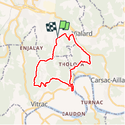
13.7 km

Max alt
208 m

Uphill gradient
385 m
Km-Effort
18.9 km

Min alt
85 m

Downhill gradient
384 m
Boucle
Yes
Creation date :
2019-06-09 12:48:30.516
Updated on :
2019-06-09 20:44:21.279
3h26
Difficulty : Difficult

FREE GPS app for hiking
 SityTrail
IGN / Geographical institutes
SityTrail Plus
The world is yours!
About
Trail Walking of 13.7 km to be discovered at New Aquitaine, Dordogne, Sarlat-la-Canéda. This trail is proposed by amelie14.
Description
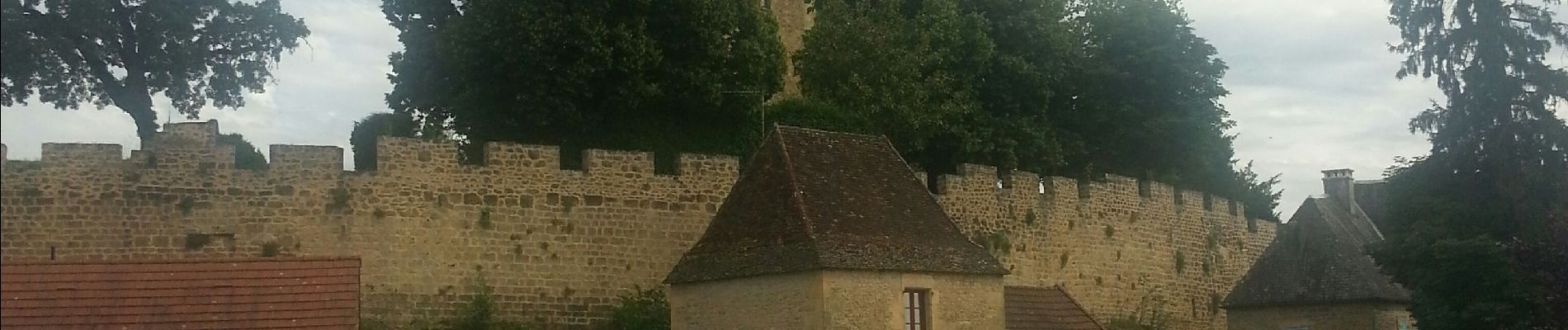
Parcours par Monfort.
Photos


Positioning
Country:
France
Region :
New Aquitaine
Department/Province :
Dordogne
Municipality :
Sarlat-la-Canéda
Location:
Unknown
Start:(Dec)
Start:(UTM)
360869 ; 4969199 (31T) N.
Comments
J 6
magnifique randonnée la traversée du village de Monfort vaut le détour