


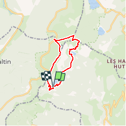
Lac Vert - lac Forlet - Gazon du Faing

patrickbeyrath
User

Length
9.2 km

Max alt
1300 m

Uphill gradient
435 m
Km-Effort
15 km

Min alt
1049 m

Downhill gradient
439 m
Boucle
Yes
Creation date :
2018-10-13 05:53:21.445
Updated on :
2018-10-13 05:53:21.47
3h05
Difficulty : Medium

FREE GPS app for hiking
 SityTrail
IGN / Geographical institutes
SityTrail Plus
The world is yours!
About
Trail Walking of 9.2 km to be discovered at Grand Est, Haut-Rhin, Soultzeren. This trail is proposed by patrickbeyrath.
Positioning
Country:
France
Region :
Grand Est
Department/Province :
Haut-Rhin
Municipality :
Soultzeren
Location:
Unknown
Start:(Dec)
Start:(UTM)
355772 ; 5327761 (32U) N.
Comments