


che soleil 1

veroarvinberod
User
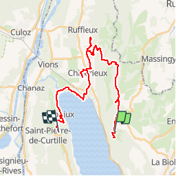

Length
30 km

Max alt
921 m

Uphill gradient
879 m
Km-Effort
43 km

Min alt
230 m

Downhill gradient
1120 m
Boucle
No
Creation date :
2019-06-12 08:46:53.195
Updated on :
2019-06-12 13:05:42.467
4h17
Difficulty : Very easy

FREE GPS app for hiking
 SityTrail
IGN / Geographical institutes
SityTrail Plus
The world is yours!
About
Trail Mountain bike of 30 km to be discovered at Auvergne-Rhône-Alpes, Savoy, Entrelacs. This trail is proposed by veroarvinberod.
Positioning
Country:
France
Region :
Auvergne-Rhône-Alpes
Department/Province :
Savoy
Municipality :
Entrelacs
Location:
Saint-Germain-la-Chambotte
Start:(Dec)
Start:(UTM)
723480 ; 5073287 (31T) N.
Comments