Trail Walking Eygluy-Escoulin - Balade au long de la Gervanne - Description et photos - Photo

Balade au long de la Gervanne - Description et photos

 bob2023
bob2023

User

© OpenStreetMap contributors
Length
Length
4.3 km
Max alt
Max alt
527 m
Uphill gradient
Uphill gradient
151 m
Km-Effort
Km-Effort  
6 km
Min alt
Min alt
400 m
Downhill gradient
Downhill gradient
58 m
Boucle
Boucle
No
Creation date :
2018-08-26 08:32:35.154
Updated on :
2018-08-26 08:32:35.171

(0 Reviews)

Walking
Walking
1h33
Difficulty : Easy

Scan this QR Code to open this trail in the SityTrail application

FREE GPS app for hiking

Logo SityTrail SityTrail

IGN / Geographical institutes

Download SityTrail from the App Store Download SityTrail from Google Play

Logo SityTrail SityTrail World

The world is yours!

Download SityTrail from the App Store Download SityTrail from Google Play Download SityTrail on Huawei AppGallery

About

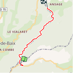
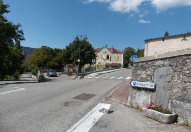
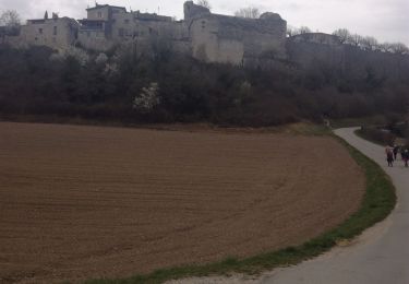
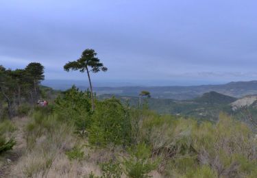
Trail Walking of 4.3 km to be discovered at Auvergne-Rhône-Alpes, Drôme, Eygluy-Escoulin. This trail is proposed by bob2023.

Description

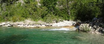
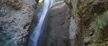
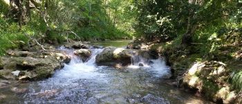
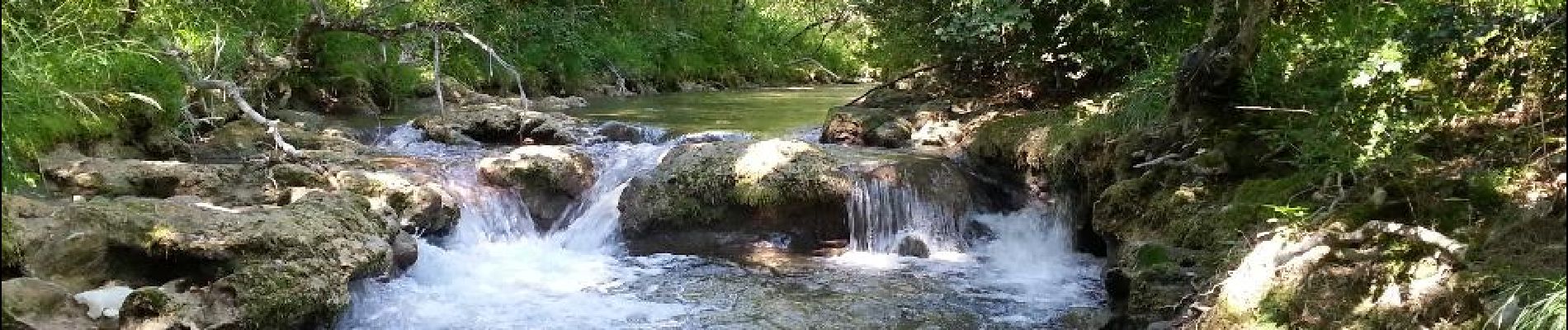
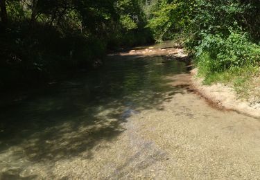
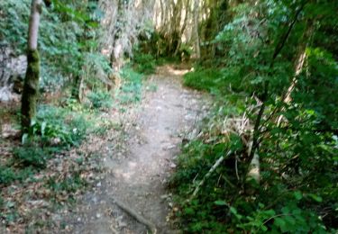
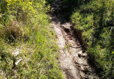
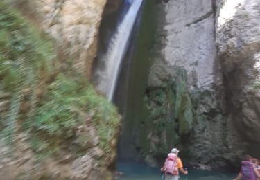
Se garer en bordure de route. Très belle rando. à faire par temps chaud. Nombreux passages dans l'eau (prévoir chaussures adéquates). Plutôt que de suivre le sentier il est possible et très agréable de remonter la Gervanne les pieds dans l'eau, vous arriverez au pied de la chute de la Druise. Les bâtons seront très utiles pour marcher dans le lit de la rivière. Pour le retour, même chemin, total environ 9 km. Note 9/10.

Elevation profile

Photos

Points of interest

Point of interest Eygluy-Escoulin - Coin baignade - Photo
bob2023
EYGLUY-ESCOULIN 
Point of interest Plan-de-Baix - Chute de la Druise - Photo
bob2023
PLAN-DE-BAIX 
Point of interest Plan-de-Baix - Gervanne - Photo
bob2023
PLAN-DE-BAIX 

Positioning

Country:
France
Region :
Auvergne-Rhône-Alpes
Department/Province :
Drôme
Municipality :
Eygluy-Escoulin
Location:
Unknown
Start:(UTM)
672112 ; 4963388 (31T) N.

Trails nearby

Trail Walking Beaufort-sur-Gervanne - Beaufort St Pancrace 17km - Photo
Walking
GUIDE
thonyc

Walking

Medium
(1)
Beaufort-sur-Gervanne, Auvergne-Rhône-Alpes, Drôme, France
15 km | 21 km-effort
5h 0min
Yes
Trail Walking Plan-de-Baix - Canyon des Gueulards - Plateau du Vellan  - Photo
Walking
Philindy26

Walking

Medium
Plan-de-Baix, Auvergne-Rhône-Alpes, Drôme, France
18.7 km | 28 km-effort
4h 55min
Yes
Trail Walking Beaufort-sur-Gervanne - 26 gervanne druise plan de baix - Photo
Walking
himba26100

Walking

Medium
Beaufort-sur-Gervanne, Auvergne-Rhône-Alpes, Drôme, France
16.8 km | 23 km-effort
7h 57min
Yes
Trail Walking Plan-de-Baix - Le Canyon des Gueulards - Photo
Walking
AIGUIER

Walking

Difficult
Plan-de-Baix, Auvergne-Rhône-Alpes, Drôme, France
14.2 km | 22 km-effort
4h 27min
Yes
Trail Walking Montclar-sur-Gervanne - Col de Gerbe - Photo
Walking
AIGUIER

Walking

Medium
Montclar-sur-Gervanne, Auvergne-Rhône-Alpes, Drôme, France
15.6 km | 22 km-effort
4h 41min
Yes
Trail Walking Beaufort-sur-Gervanne - Beaufort sur gervanne - Photo
Walking
AIGUIER

Walking

Medium
Beaufort-sur-Gervanne, Auvergne-Rhône-Alpes, Drôme, France
13.4 km | 20 km-effort
4h 40min
Yes
Trail Walking Beaufort-sur-Gervanne - Beaufort tour du merly  - Photo
Walking
Joel26400

Walking

Easy
(1)
Beaufort-sur-Gervanne, Auvergne-Rhône-Alpes, Drôme, France
19.3 km | 29 km-effort
6h 43min
Yes
Trail Walking Omblèze - les 3 perles de la servante. - Photo
Walking
Joel26400

Walking

Medium
Omblèze, Auvergne-Rhône-Alpes, Drôme, France
23 km | 35 km-effort
8h 35min
Yes
Trail On foot Montclar-sur-Gervanne - 04-MAR-20 - Photo
On foot
TOULAUDIN

On foot

Medium
Montclar-sur-Gervanne, Auvergne-Rhône-Alpes, Drôme, France
16.8 km | 25 km-effort
Unknown
Yes


Close
My subscriptions