Trail Walking Vescles - Le Pic d'Oliferne - Photo
 albert39
albert39

User

© OpenStreetMap contributors
Length
Length
12.5 km
Max alt
Max alt
787 m
Uphill gradient
Uphill gradient
383 m
Km-Effort
Km-Effort  
17.6 km
Min alt
Min alt
517 m
Downhill gradient
Downhill gradient
381 m
Boucle
Boucle
Yes
Creation date :
2014-12-10 00:00:00.0
Updated on :
2014-12-10 00:00:00.0

(1 Reviews)

Walking
Walking
3h46
Difficulty : Difficult

Scan this QR Code to open this trail in the SityTrail application

FREE GPS app for hiking

Logo SityTrail SityTrail

IGN / Geographical institutes

Download SityTrail from the App Store Download SityTrail from Google Play

Logo SityTrail SityTrail World

The world is yours!

Download SityTrail from the App Store Download SityTrail from Google Play Download SityTrail on Huawei AppGallery

About

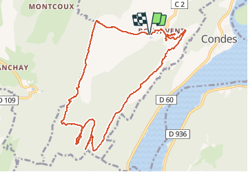
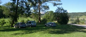
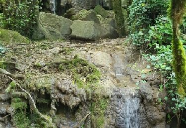
Trail Walking of 12.5 km to be discovered at Bourgogne-Franche-Comté, Jura, Vescles. This trail is proposed by albert39.

Description

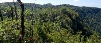
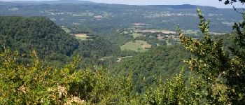
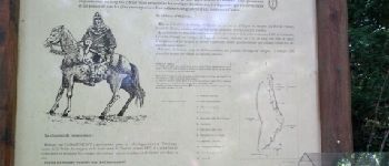
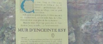
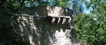
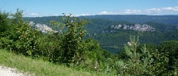
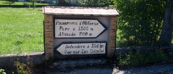
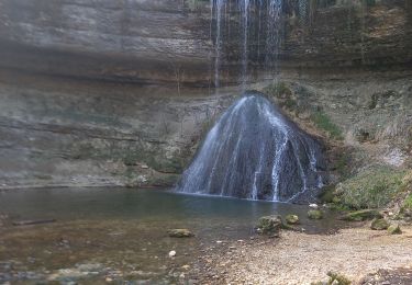
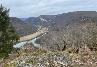
Superbe belvédère au-dessus des vallées de l'Ain et de la Valouse, la pic d'Oliferne est aussi un lieu chargé d’histoire et de légendes fantastiques.

Elevation profile

Photos

Points of interest

Point of interest Vescles - Point 1 - Photo
albert39
VESCLES 
Point of interest Vescles - Point 2 - Photo
albert39
VESCLES 
Point of interest Saint-Hymetière-sur-Valouse - Point 3 - Photo
albert39
SAINT-HYMETIÈRE-SUR-VALOUSE 
Point of interest Vescles - Point 4 - Photo
albert39
VESCLES 
Point of interest Vescles - Point 5 - Photo
albert39
VESCLES 
Point of interest Vescles - Point 6 - Photo
albert39
VESCLES 
Point of interest Vescles - Point 7 - Photo
albert39
VESCLES 
Point of interest Vescles - Point 8 - Photo
albert39
VESCLES 
Point of interest Vescles - Point 9 - Photo
albert39
VESCLES 
Point of interest Vescles - Point 10 - Photo
albert39
VESCLES 
Point of interest Vescles - Point 11 - Photo
albert39
VESCLES 
Point of interest Vescles - Point 12 - Photo
albert39
VESCLES 
Point of interest Vescles - Point 13 - Photo
albert39
VESCLES 
Point of interest Vescles - Point 14 - Photo
albert39
VESCLES 

Positioning

Country:
France
Region :
Bourgogne-Franche-Comté
Department/Province :
Jura
Municipality :
Vescles
Location:
Unknown
Start:(UTM)
700612 ; 5134895 (31T) N.

Comments

Please log in to post a review or rate the element


Trails nearby

Trail Walking Dortan - col de la Tendue pierre qui vire  - Photo
Walking
Jackoyo

Walking

Difficult
Dortan, Auvergne-Rhône-Alpes, Ain, France
9.2 km | 15.5 km-effort
2h 51min
Yes
Trail Walking Saint-Hymetière-sur-Valouse - st hymetiere jura  - Photo
Walking
colomb24

Walking

Difficult
Saint-Hymetière-sur-Valouse, Bourgogne-Franche-Comté, Jura, France
11.9 km | 15.2 km-effort
21h 27min
Yes
Trail Walking Dortan - vouais. la pierre qui vire.la cascade de la combe. - Photo
Walking
colomb24

Walking

Easy
Dortan, Auvergne-Rhône-Alpes, Ain, France
10 km | 14.7 km-effort
2h 51min
Yes
Trail On foot Dortan - La Pierre qui vire - Photo
On foot
PRO

On foot

Easy
Dortan, Auvergne-Rhône-Alpes, Ain, France
3.1 km | 6.1 km-effort
1h 23min
No
Trail Walking Dortan - Boucle sur les hauteurs de Dortan  - Photo
Walking
zefreefly

Walking

Medium
Dortan, Auvergne-Rhône-Alpes, Ain, France
18.1 km | 28 km-effort
4h 35min
Yes
Trail Walking Dortan - vouais - Photo
Walking
colomb24

Walking

Difficult
Dortan, Auvergne-Rhône-Alpes, Ain, France
14.3 km | 22 km-effort
7h 11min
Yes
Trail Walking Dortan - dortan .la pierre qui vire  .les 3 dammetes et  retour dortant retour  - Photo
Walking
colomb24

Walking

Medium
Dortan, Auvergne-Rhône-Alpes, Ain, France
13.7 km | 20 km-effort
4h 32min
Yes
Trail Walking Vescles - Vescles Sous le pic d'oliferne  - Photo
Walking
Jackoyo

Walking

Medium
Vescles, Bourgogne-Franche-Comté, Jura, France
13.3 km | 18 km-effort
3h 5min
Yes
Trail Walking Saint-Hymetière-sur-Valouse - gorges de la valouse - Photo
Walking
patou39

Walking

Easy
(1)
Saint-Hymetière-sur-Valouse, Bourgogne-Franche-Comté, Jura, France
7.2 km | 9.4 km-effort
1h 58min
Yes


Close
My subscriptions