


CC_Velay_FB_25_Aire-Adour_Arzacq-Arraziguet_20081110

patrickdanilo
User
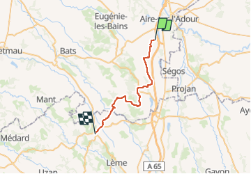

Length
29 km

Max alt
236 m

Uphill gradient
427 m
Km-Effort
34 km

Min alt
112 m

Downhill gradient
356 m
Boucle
No
Creation date :
2019-06-22 14:53:21.948
Updated on :
2022-09-18 18:57:06.065
7h00
Difficulty : Easy

FREE GPS app for hiking
 SityTrail
IGN / Geographical institutes
SityTrail Plus
The world is yours!
About
Trail Walking of 29 km to be discovered at New Aquitaine, Landes, Aire-sur-l'Adour. This trail is proposed by patrickdanilo.
Description
Randonnée Marche de 29 km à découvrir à Nouvelle-Aquitaine, Landes, Aire-sur-l'Adour. Cette randonnée est proposée par patrickdanilo.
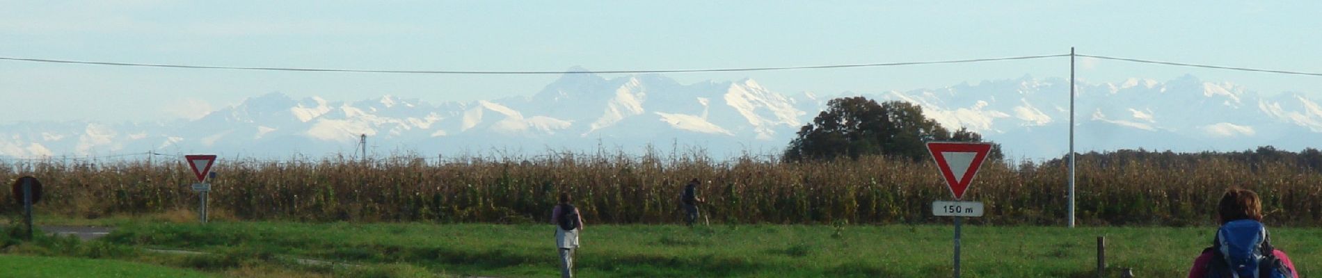
Photos


Positioning
Country:
France
Region :
New Aquitaine
Department/Province :
Landes
Municipality :
Aire-sur-l'Adour
Location:
Unknown
Start:(Dec)
Start:(UTM)
718281 ; 4838808 (30T) N.
Comments