


SityTrail - col de la fenêtre

bob2023
User
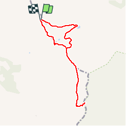

Length
7.8 km

Max alt
2242 m

Uphill gradient
351 m
Km-Effort
12.4 km

Min alt
1919 m

Downhill gradient
347 m
Boucle
Yes
Creation date :
2019-06-23 12:23:58.756
Updated on :
2019-06-23 12:51:49.727
2h34
Difficulty : Medium

FREE GPS app for hiking
 SityTrail
IGN / Geographical institutes
SityTrail Plus
The world is yours!
About
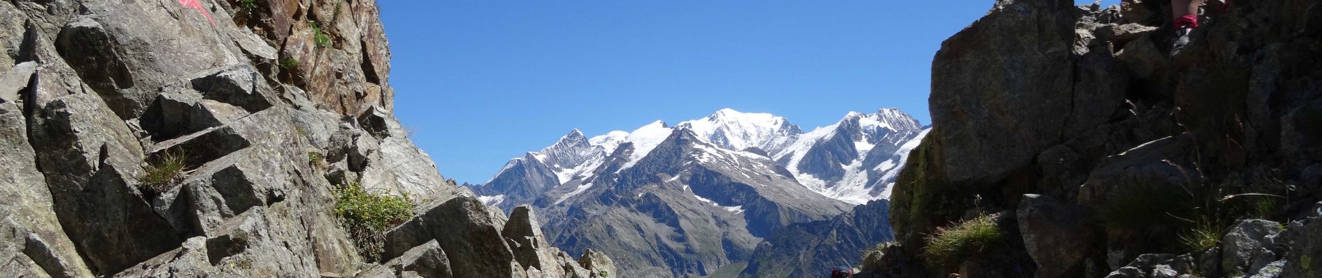
Trail Walking of 7.8 km to be discovered at Auvergne-Rhône-Alpes, Savoy, Hauteluce. This trail is proposed by bob2023.
Photos

Positioning
Country:
France
Region :
Auvergne-Rhône-Alpes
Department/Province :
Savoy
Municipality :
Hauteluce
Location:
Unknown
Start:(Dec)
Start:(UTM)
319197 ; 5072672 (32T) N.
Comments