


RP66 - LAROQUE DES ALBERES - SOREDE - le 25/06/2019

jeff66
User
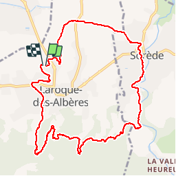

Length
11.9 km

Max alt
216 m

Uphill gradient
190 m
Km-Effort
14.4 km

Min alt
58 m

Downhill gradient
191 m
Boucle
Yes
Creation date :
2019-06-25 05:56:16.0
Updated on :
2019-06-25 08:17:26.983
2h01
Difficulty : Difficult

FREE GPS app for hiking
 SityTrail
IGN / Geographical institutes
SityTrail Plus
The world is yours!
About
Trail Walking of 11.9 km to be discovered at Occitania, Pyrénées-Orientales, Laroque-des-Albères. This trail is proposed by jeff66.
Positioning
Country:
France
Region :
Occitania
Department/Province :
Pyrénées-Orientales
Municipality :
Laroque-des-Albères
Location:
Unknown
Start:(Dec)
Start:(UTM)
494346 ; 4708452 (31T) N.
Comments