


M66 LAROQUE ST GENIS LAROQUE

jeff66
User

Length
8.8 km

Max alt
92 m

Uphill gradient
63 m
Km-Effort
9.6 km

Min alt
38 m

Downhill gradient
62 m
Boucle
Yes
Creation date :
2019-07-02 07:00:16.0
Updated on :
2019-07-02 16:19:34.392
1h32
Difficulty : Medium

FREE GPS app for hiking
 SityTrail
IGN / Geographical institutes
SityTrail Plus
The world is yours!
About
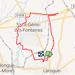
Trail Walking of 8.8 km to be discovered at Occitania, Pyrénées-Orientales, Laroque-des-Albères. This trail is proposed by jeff66.
Description
RP66 LAROQUE-DES-ALBÈRES. - les vernèdes - ch. de la boutade - St genis - staff - cave coop - piste cycle-pédestre - la Prade . Ch. de Tanya - Laroque-des-Albères - le 02.07.2019
Positioning
Country:
France
Region :
Occitania
Department/Province :
Pyrénées-Orientales
Municipality :
Laroque-des-Albères
Location:
Unknown
Start:(Dec)
Start:(UTM)
494286 ; 4708458 (31T) N.
Comments