


chapelle saint michel

lecmic
User
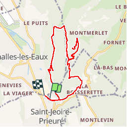

Length
9.8 km

Max alt
879 m

Uphill gradient
594 m
Km-Effort
17.7 km

Min alt
326 m

Downhill gradient
596 m
Boucle
Yes
Creation date :
2019-07-11 07:43:57.582
Updated on :
2019-07-11 14:02:04.536
4h59
Difficulty : Medium

FREE GPS app for hiking
 SityTrail
IGN / Geographical institutes
SityTrail Plus
The world is yours!
About
Trail Walking of 9.8 km to be discovered at Auvergne-Rhône-Alpes, Savoy, Saint-Jeoire-Prieuré. This trail is proposed by lecmic.
Description
ballade sportive
Positioning
Country:
France
Region :
Auvergne-Rhône-Alpes
Department/Province :
Savoy
Municipality :
Saint-Jeoire-Prieuré
Location:
Unknown
Start:(Dec)
Start:(UTM)
733695 ; 5047158 (31T) N.
Comments