


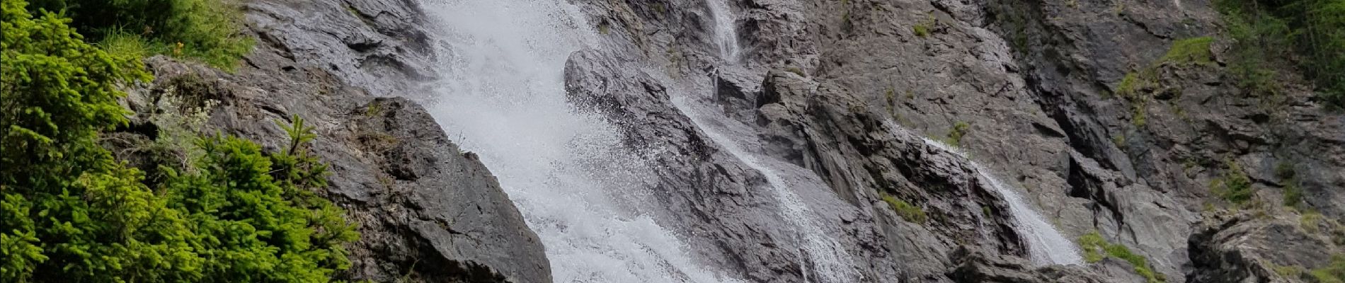
La cascade de la Raie depuis la Bataillette

fredmig67
User
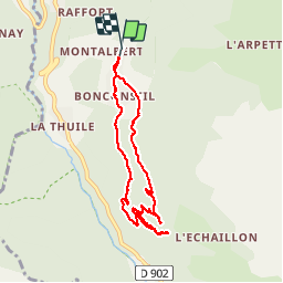

Length
7.7 km

Max alt
1739 m

Uphill gradient
487 m
Km-Effort
14.2 km

Min alt
1475 m

Downhill gradient
487 m
Boucle
Yes
Creation date :
2019-07-12 12:10:34.912
Updated on :
2019-07-13 10:11:47.179
3h07
Difficulty : Medium

FREE GPS app for hiking
 SityTrail
IGN / Geographical institutes
SityTrail Plus
The world is yours!
About
Trail Walking of 7.7 km to be discovered at Auvergne-Rhône-Alpes, Savoy, Sainte-Foy-Tarentaise. This trail is proposed by fredmig67.
Description
Attention le retour vers Bonconseil après la vue sur la cascade comprend quelques passages difficiles, le sentier n'étant pas entretenu et ayant connu un éboulement.
Photos


Positioning
Country:
France
Region :
Auvergne-Rhône-Alpes
Department/Province :
Savoy
Municipality :
Sainte-Foy-Tarentaise
Location:
Unknown
Start:(Dec)
Start:(UTM)
335742 ; 5049576 (32T) N.
Comments