Trail Walking Lunel - RP34+30 LUNEL - AIMARGUES - MARSILLARGUES - LUNEL - Photo

RP34+30 LUNEL - AIMARGUES - MARSILLARGUES - LUNEL

 jeff66
jeff66

User

© OpenStreetMap contributors
Length
Length
19.1 km
Max alt
Max alt
15 m
Uphill gradient
Uphill gradient
89 m
Km-Effort
Km-Effort  
20 km
Min alt
Min alt
2 m
Downhill gradient
Downhill gradient
90 m
Boucle
Boucle
Yes
Creation date :
2019-07-13 04:45:52.0
Updated on :
2019-07-13 10:05:00.742

(0 Reviews)

Walking
Walking
3h37
Difficulty : Difficult

Scan this QR Code to open this trail in the SityTrail application

FREE GPS app for hiking

Logo SityTrail SityTrail

IGN / Geographical institutes

Download SityTrail from the App Store Download SityTrail from Google Play

Logo SityTrail SityTrail World

The world is yours!

Download SityTrail from the App Store Download SityTrail from Google Play Download SityTrail on Huawei AppGallery

About

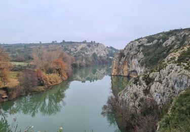
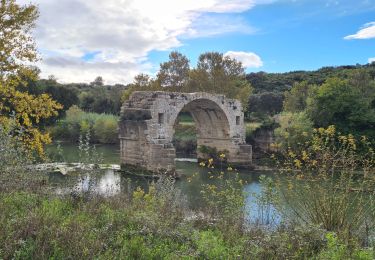
Trail Walking of 19.1 km to be discovered at Occitania, Hérault, Lunel. This trail is proposed by jeff66.

Description

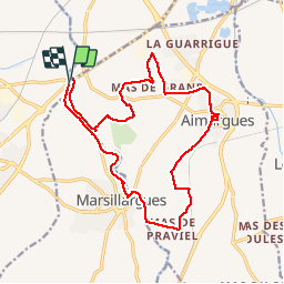
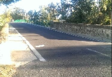
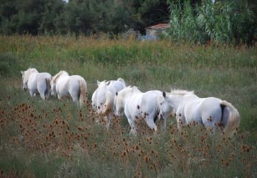
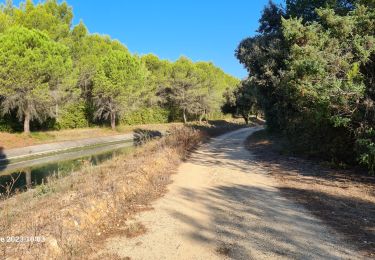
RP34 30 LUNEL - pont de Lunel - berge du vidourle - mas de l’aire, rieutord et ST Rémy - AIMARGUES - centre ville - La jouberte - le creux de blanc - plan de praviel - château de Teillan - MARSILLARGUES - pont Boulet - berges du vidourle - Langlon - le moulin Bernard - pont de LUNEL - le 13.07.19

Elevation profile

Positioning

Country:
France
Region :
Occitania
Department/Province :
Hérault
Municipality :
Lunel
Location:
Unknown
Start:(UTM)
593794 ; 4838370 (31T) N.

Trails nearby

Trail Walking Marsillargues - vidourle et marsillargues - Photo
Walking
Prince2b

Walking

Easy
(1)
Marsillargues, Occitania, Hérault, France
7.3 km | 7.8 km-effort
1h 27min
Yes
Trail Mountain bike Villetelle - Grande Traversée de l'Hérault à VTT - De Ambrussum à Fondespierre - Photo
Mountain bike
tracegps

Mountain bike

Medium
(2)
Villetelle, Occitania, Hérault, France
29 km | 33 km-effort
3h 30min
No
Trail Walking Lunel - Le canal de Lunel - l'échappée belle au coeur des marais - Photo
Walking
tracegps

Walking

Medium
(3)
Lunel, Occitania, Hérault, France
21 km | 21 km-effort
5h 0min
Yes
Trail Equestrian Gallargues-le-Montueux - Aujargues - Photo
Equestrian
N-Letessier

Equestrian

Easy
(1)
Gallargues-le-Montueux, Occitania, Gard, France
28 km | 32 km-effort
5h 33min
Yes
Trail Walking Marsillargues - marsillargues_ aymargues  - Photo
Walking
v.rabot

Walking

Medium
Marsillargues, Occitania, Hérault, France
12.3 km | 13.1 km-effort
3h 21min
Yes
Trail Walking Lunel - lunel_tour_de_farge - Photo
Walking
v.rabot

Walking

Medium
Lunel, Occitania, Hérault, France
13.4 km | 15.4 km-effort
3h 30min
Yes
Trail Walking Villetelle - villetelle  - Photo
Walking
v.rabot

Walking

Easy
Villetelle, Occitania, Hérault, France
6.6 km | 7.9 km-effort
1h 34min
Yes
Trail Walking Aubais - moulin-carriere-gallargues - Photo
Walking
v.rabot

Walking

Easy
Aubais, Occitania, Gard, France
12.5 km | 14.1 km-effort
2h 30min
Yes
Trail Walking Villetelle - Sensei pascal  - Photo
Walking
rio34740

Walking

Medium
Villetelle, Occitania, Hérault, France
17.7 km | 0 m-effort
5h 17min
Yes


Close
My subscriptions